Approximate Location Map
Large Map »
Latitude: 52.0745 / 52°4'28"N
Longitude: -3.1251 / 3°7'30"W
OS Eastings: 322983
OS Northings: 242394
OS Grid: SO229423
Mapcode National: GBR F1.CFFK
Mapcode Global: VH6BJ.S37Z
Plus Code: 9C4R3VFF+RX
Entry Name: Havards
Listing Date: 1 February 1988
Last Amended: 1 February 1988
Grade: II
Source: Cadw
Source ID: 7360
Building Class: Domestic
ID on this website: 300007360
Location: Stepped down from adjoining properties.
County: Powys
Community: Hay (Y Gelli Gandryll)
Community: Hay
Built-Up Area: Hay-on-Wye
Traditional County: Brecknockshire
Tagged with: Building
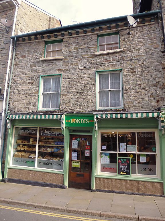
Early C19 3-storey 2-window mainly coursed rubble front - heavily pointed. Slate roof with undulating bracket cornice. Recessed horned sash windows, 6-pane to 2nd floor and 4-pane to 1st floor. Overall shop front with end pilasters and fascia end brackets; horned 6-pane sash window to right, 2-pane window to left, central entrance and modern door.
Group value.
External links are from the relevant listing authority and, where applicable, Wikidata. Wikidata IDs may be related buildings as well as this specific building. If you want to add or update a link, you will need to do so by editing the Wikidata entry.


Other nearby listed buildings
