Approximate Location Map
Large Map »
Latitude: 52.072 / 52°4'19"N
Longitude: -3.1308 / 3°7'50"W
OS Eastings: 322588
OS Northings: 242117
OS Grid: SO225421
Mapcode National: GBR F1.CL19
Mapcode Global: VH6BJ.P56Y
Plus Code: 9C4R3VC9+QM
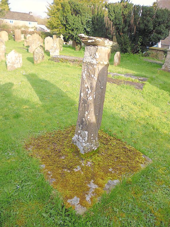
Entry Name: Sundial in the Churchyard of St Mary's Parish Church
Listing Date: 1 February 1988
Last Amended: 1 February 1988
Grade: II
Source: Cadw
Source ID: 7411
Building Class: Gardens, Parks and Urban Spaces
Also known as: Bathafarn Hall
Bathafarn Park
ID on this website: 300007411
Location: To S of the Parish Church near the edge of the churchyard.
County: Powys
Community: Hay (Y Gelli Gandryll)
Community: Hay
Built-Up Area: Hay-on-Wye
Traditional County: Brecknockshire
Tagged with: Sundial Country house
Dated 1826.
Square stem ca 4ft. high, splayed out to top retaining the lead octagonal dial and gnomon. Inscribed "Parish of Hay 1826, Joseph Huil (?) fecit Birmingham" and gives the names of four church-wardens and overseers.
Group value with the Parish Church.
External links are from the relevant listing authority and, where applicable, Wikidata. Wikidata IDs may be related buildings as well as this specific building. If you want to add or update a link, you will need to do so by editing the Wikidata entry.


Other nearby listed buildings
