Approximate Location Map
Large Map »
Latitude: 51.7481 / 51°44'53"N
Longitude: -4.5666 / 4°33'59"W
OS Eastings: 222922
OS Northings: 208604
OS Grid: SN229086
Mapcode National: GBR GJ.03GG
Mapcode Global: VH2PG.SBQ8
Plus Code: 9C3QPCXM+69
Entry Name: The Great House and attached outbuildings
Listing Date: 30 November 1966
Last Amended: 4 December 2000
Grade: II
Source: Cadw
Source ID: 9408
Building Class: Domestic
ID on this website: 300009408
Location: Situated SE of the church at Pendine some 200m S of the junction of the B4314 and a minor road to Marros.
County: Carmarthenshire
Town: Carmarthen
Community: Pendine (Pen-tywyn)
Community: Pendine
Built-Up Area: Pendine
Traditional County: Carmarthenshire
Tagged with: Building
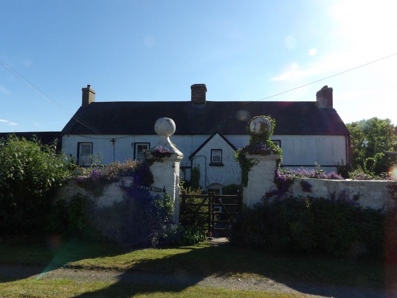
Farmhouse, former gentry house, C17. Owned by the Barrett family from mid C16, in 1610 named as the Greate House, when conveyed to William Barrett (d 1635). By 1670s owned by Price family, and sold by them in 1753 to the Gwynne Vaughan of Jordanston. Sold to Dr John Jones of Haverfordwest whose daughter married Thomas Lloyd of Bronwydd, Cardiganshire (d 1807). The present house looks later C17, so may have been rebuilt by the Price family.
House with farm-buildings in line. House is whitewashed roughcast with slate roofs, rendered left stack, stone ridge stack (with stone dripcourses) and red brick right stack. Two storeys and attic, long 4-window front with projecting gabled 2-storey porch bay in third bay. Three 4-pane horned sashes above with sill band, 3 PVCu windows below replacing sashes. Porch gable has square PVCu upper window and cambered-arched doorway with PVCu door. Whitewashed rubble stone N end wall with one first floor PVCu window. Rubble stone rear with SW rear wing and end stack. Rear wing has lean-to outshut on rear, filling angle to main house rear wall, which has first floor centre window and C20 window to ground floor left.
Outbuildings attached to left: first a whitewashed lofted range with corrugated iron roof, coped gable left and centre cambered-headed door, loft door above to left and door to extreme left. Next section is lower (probably a later addition - perhaps stable and cartshed), with corrugated iron roof, C20 lean-to added milking parlour to right, then 5 doors all with stone voussoirs, some part-blocked as windows. Final L-plan section has partly collapsed roof of asbestos sheet and slate. Window and door with stone voussoirs in main part, while return has cart entry with oak lintel and loft light over. Gable end has loft door and outside steps.
Three-room plan with staircase hall between kitchen to N and former two rooms, now one to S. Staircase is earlier C19 with single flight to landing, stick balusters and bulbous turned newels. Scrolled tread ends. Six-panel doors, earlier C19. Kitchen is modernised but said to have fireplace of some 4.3m by 1.2m behind present N wall.
S room has 6-panel door, large stone fireplace at N end with stone voussoirs. Recess with timber lintel to right. Two large chamfered beams, thin chamfer and run-out stop. The beam at S end (in former S room) is encased in C20 plaster, but on stone corbels. C20 S end fireplace, stone corbel under ceiling to right. First floor has high ceilings, corridor along rear wall. Rear wing first floor room has C19 three-sided boarded ceiling, and was formerly a grain loft. Front rooms have 6-panel doors. Small C19 fireplace with iron grate in middle room.
Included as a linear farmstead range with significant C17 gentry house retaining vernacular character (notwithstanding alteration to detail). An unusually early survivor in this region.
External links are from the relevant listing authority and, where applicable, Wikidata. Wikidata IDs may be related buildings as well as this specific building. If you want to add or update a link, you will need to do so by editing the Wikidata entry.


Other nearby listed buildings
