Latitude: 51.7726 / 51°46'21"N
Longitude: -4.4629 / 4°27'46"W
OS Eastings: 230169
OS Northings: 211080
OS Grid: SN301110
Mapcode National: GBR D7.ZKNH
Mapcode Global: VH3LS.LQH0
Plus Code: 9C3QQGFP+2R
Entry Name: Moir House
Listing Date: 30 November 1966
Last Amended: 25 September 1986
Grade: II
Source: Cadw
Source ID: 9632
Building Class: Domestic
ID on this website: 300009632
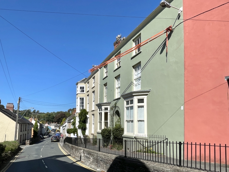
Location: Set across the slope, attached to The Limes on the left and Rosetta at an angle to the right; ramped and iron railed path above the road to front.
County: Carmarthenshire
Community: Laugharne Township (Treflan Lacharn)
Community: Laugharne Township
Built-Up Area: Laugharne
Traditional County: Carmarthenshire
Tagged with: Architectural structure
Late C18, one roof truss said to be dated 1790. Georgian 3-storey, 3-window rendered front with later alterations, built with The Limes and known as Big House; divided up ca 1900. Slate roof, dentiled eaves, brick chimney stacks; small pane sash windows to 1st and 2nd floors (with horns to latter); ca 1900 splayed bays to ground floor with iron railins to flat roofs, advanced dentiled cornices and some coloured glass above sash windows. Arched entrances to centre with trellis porch; recessed 6-panel door qnd 5-pane petal fanlight. Formerly with storeyed bay to right to balance the dront when one property with The Limes. Rendered rear with pyramidal roofed and lowe gabled extensions.
Interior retains what was the main staircase to Big House, formerly with pyramidal lantern; classical detailing to cornices and fireplaces.
Group value.
External links are from the relevant listing authority and, where applicable, Wikidata. Wikidata IDs may be related buildings as well as this specific building. If you want to add or update a link, you will need to do so by editing the Wikidata entry.


Other nearby listed buildings