History in Structure

War Memorial

A Grade II Listed Building in Llwydcoed, Rhondda Cynon Taff

More Photos »
Approximate Location Map
Large Map »

Coordinates

Latitude: 51.7352 / 51°44'6"N

Longitude: -3.4609 / 3°27'39"W

OS Eastings: 299216

OS Northings: 205061

OS Grid: SN992050

Mapcode National: GBR HK.1VKD

Mapcode Global: VH5GF.YNR5

Plus Code: 9C3RPGPQ+3M

Entry Name: War Memorial

Listing Date: 10 January 1991

Last Amended: 10 January 1991

Grade: II

Source: Cadw

Source ID: 10896

Building Class: Commemorative

Also known as: War Memorial, Merthyr Road, Tre-Gibbon

ID on this website: 300010896

Location: At the top of Llwydcoed Park immediately to S of the area of Tre-Gibbon.

County: Rhondda Cynon Taff

Community: Llwydcoed (Llwytgoed)

Community: Llwydcoed

Locality: Tre-Gibbon

Built-Up Area: Aberdare

Traditional County: Glamorgan

Tagged with: Obelisk War memorial

Find accommodation in
Aberdare

History

Unveiled 28th September l921 and was said to be the first public war monument in the district; cost ú600.

Exterior

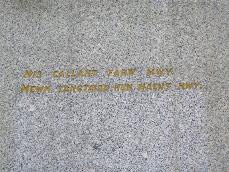
Obelisk type; constructed of Aberdeen granite tapered and with no ornament. Inscribed pedestal and stepped plinth; surrounded by iron railings with pointed arches and taller corner posts.

External Links

External links are from the relevant listing authority and, where applicable, Wikidata. Wikidata IDs may be related buildings as well as this specific building. If you want to add or update a link, you will need to do so by editing the Wikidata entry.

Recommended Books

Other nearby listed buildings

  • II Merthyr Road Railway Bridge
    Towards the N end of Llwydcoed where the Merthyr Road rises over the disused railway cutting.
  • II St James' Church
    Set in a slight slope on the corner with Merthyr Road at the NW end of the village. Opposite the junction with Cwmynysmintan Road.
  • II Llwydcoed Tramroad Bridge
    Spans the River Cynon at the boundary between the Communities of Aberdare and Llwydcoed. Reached by a lane from the roundabout to SE, past the factory; in the area known as Gelli-Isaf. Steep wooded
  • II Vicarage to St Fagan's Church
    Immediately to NE of the Church, slightly stepped down. Reached up a lane from the street; also direct from the churchyard.
  • II St. Fagan's Church
    Reached by lane from the street and tree lined path. Set at the northern end of a sloping, walled, churchyard. Vicarage immediately to NE.
  • II Gate Piers at former Railway Crossing
    At the northern edge of Trecynon; beside the road at the 'S' bend.
  • II Hall attached to Capel Y Bedyddwyr
    Built in l852 to the design of Thomas Joseph, local coal owner and engineer; cost ú920. Became a self-governing church in l855 and then in l893 was extensively remodelled. In l904 further alteration
  • II Heol Y Felin (Capel Y Bedyddwyr)
    Above the road and set back behind forecourt including small burial ground.

BritishListedBuildings.co.uk is an independent online resource and is not associated with any government department. All government data published here is used under licence. Please do not contact BritishListedBuildings.co.uk for any queries related to any individual listed building, planning permission related to listed buildings or the listing process itself.

British Listed Buildings is a Good Stuff website.