Approximate Location Map
Large Map »
Latitude: 51.5069 / 51°30'24"N
Longitude: -3.5751 / 3°34'30"W
OS Eastings: 290783
OS Northings: 179834
OS Grid: SS907798
Mapcode National: GBR HD.J9GV
Mapcode Global: VH5HJ.ZDC6
Plus Code: 9C3RGC4F+PX
Entry Name: Bridgend Railway Station Pedestrian Bridge
Listing Date: 29 September 1986
Last Amended: 29 September 1986
Grade: II
Source: Cadw
Source ID: 11307
Building Class: Transport
Also known as: Bridgend Railway Station Pedestrian Bridge
ID on this website: 300011307
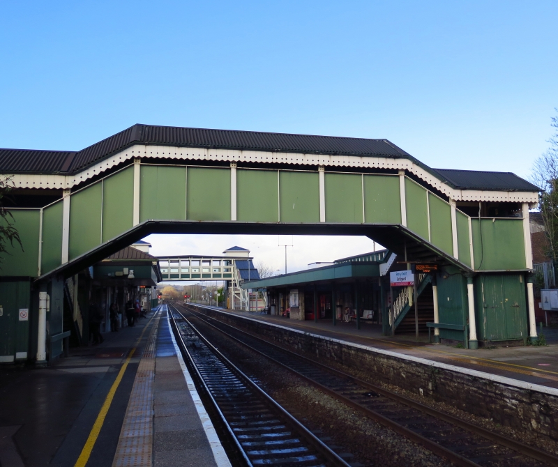
Location: Linking the W and E platforms.
County: Bridgend
Town: Brdgend
Community: Bridgend (Pen-y-bont ar Ogwr)
Community: Bridgend
Built-Up Area: Bridgend
Traditional County: Glamorgan
Tagged with: Railway footbridge
Added in 1877 to I K Brunel’s station of 1850;
iron and timber construction with some modern alterations. Ornate cast-iron banisters and columns with foliated capitals supporting the half-landing. Modern roof, with Gothic valence, and blind infill to sides.
Group value.
External links are from the relevant listing authority and, where applicable, Wikidata. Wikidata IDs may be related buildings as well as this specific building. If you want to add or update a link, you will need to do so by editing the Wikidata entry.


Other nearby listed buildings
