Approximate Location Map
Large Map »
Latitude: 51.7491 / 51°44'56"N
Longitude: -3.384 / 3°23'2"W
OS Eastings: 304554
OS Northings: 206506
OS Grid: SO045065
Mapcode National: GBR HN.13HC
Mapcode Global: VH6CY.99CH
Plus Code: 9C3RPJX8+JC
Entry Name: Jackson's Bridge
Listing Date: 20 January 1981
Last Amended: 13 January 1988
Grade: II
Source: Cadw
Source ID: 11388
Building Class: Transport
ID on this website: 300011388
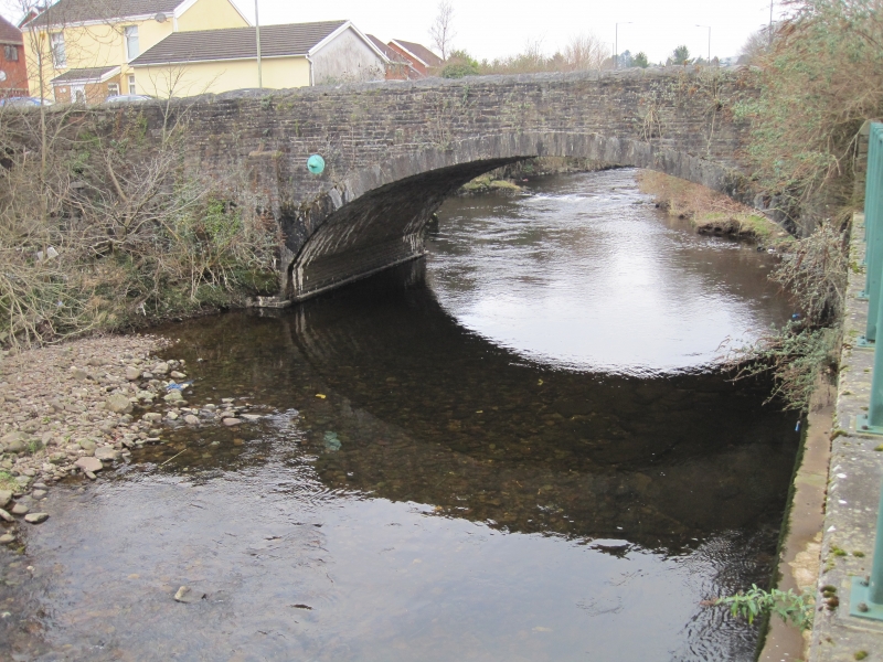
Location: Road bridge spanning the River Taff between Morgantown and Georgetown on W bank.
County: Merthyr Tydfil
Community: Park (Parc)
Community: Park
Locality: Morganstown
Built-Up Area: Merthyr Tydfil
Traditional County: Glamorgan
Tagged with: Bridge Road bridge
Early C19 (shown on 1836 Survey Plan of Merthyr).
Formerly a dual purpose road and Dowlais Tramroad bridge of stone rubble with arch of wide span with dressed voussoirs. Flanking pilasters on stepped plinths; parapets with stone copings.
External links are from the relevant listing authority and, where applicable, Wikidata. Wikidata IDs may be related buildings as well as this specific building. If you want to add or update a link, you will need to do so by editing the Wikidata entry.


Other nearby listed buildings
