Latitude: 51.667 / 51°40'1"N
Longitude: -3.7913 / 3°47'28"W
OS Eastings: 276214
OS Northings: 197992
OS Grid: SS762979
Mapcode National: GBR H3.6337
Mapcode Global: VH5GN.7CKD
Plus Code: 9C3RM685+RF
Entry Name: Gatepiers to St Illtyd's Church
Listing Date: 5 January 1989
Last Amended: 5 January 1989
Grade: II
Source: Cadw
Source ID: 11798
Building Class: Religious, Ritual and Funerary
ID on this website: 300011798
Location: At the side of the road opposite the Llantwit Cemetery on the outskirts of the town.
County: Neath Port Talbot
Community: Neath (Castell-nedd)
Community: Neath
Built-Up Area: Neath
Traditional County: Glamorgan
Tagged with: Pier
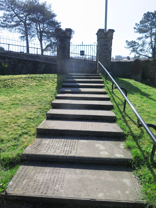
Early C19.
Tall slender rubble gatepiers, dressed regular quoins, crenellated Gothic limestone caps. Later C19 ironwork gate. (Contemporary with similar gatepiers at St Thomas’ Parish Church).
Group value with St Illtyd’s Church.
External links are from the relevant listing authority and, where applicable, Wikidata. Wikidata IDs may be related buildings as well as this specific building. If you want to add or update a link, you will need to do so by editing the Wikidata entry.


Other nearby listed buildings