Approximate Location Map
Large Map »
Latitude: 51.4626 / 51°27'45"N
Longitude: -3.4521 / 3°27'7"W
OS Eastings: 299218
OS Northings: 174739
OS Grid: SS992747
Mapcode National: GBR HK.M4DK
Mapcode Global: VH6F8.3HVL
Plus Code: 9C3RFG7X+35
Entry Name: National Westminster Bank
Listing Date: 3 February 1981
Last Amended: 16 September 1999
Grade: II
Source: Cadw
Source ID: 13239
Building Class: Domestic
ID on this website: 300013239
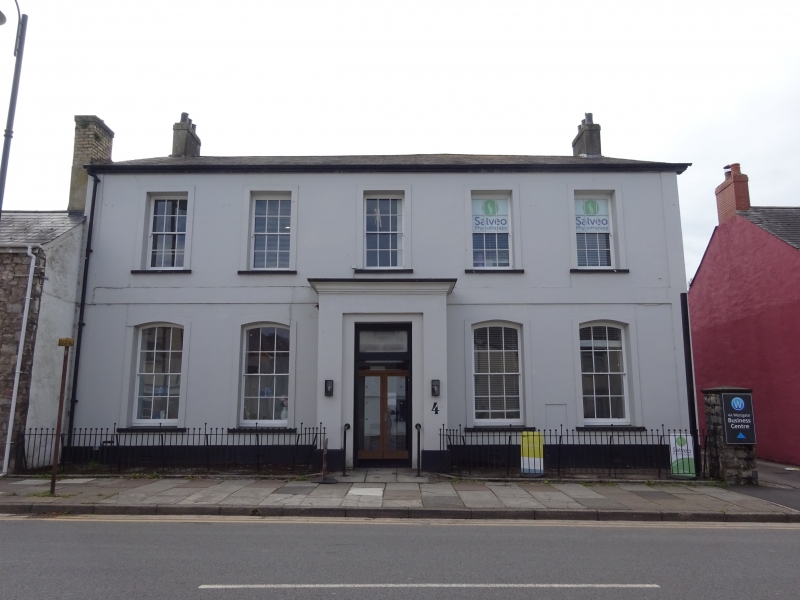
The National Provincial Bank was established in Cowbridge in 1835; but on the Tithe Map, stamped 1843, and apportionment of 1840, the site of the "National Bank" is shown on the present site of no 62 High Street.
Mid C19. Two storeys. Five bay front elevation with stuccoed render and slate gabled roof with stuccoed flanking stacks. On ground floor, four tall segmentally headed sash windows (12-pane, hornless); square prostyle centre porch with stuccoed moulded cornice, rectangular recess in each return and front square-headed doorway in rectangular recess doorway with plain overlight and double mid to later C19 style moulded panelled doors. Five square-headed sash windows (12-pane, horned) on first floor. Late C19 hood to ground floor doorway in R elevation.
Well-preserved C19 bank building.
External links are from the relevant listing authority and, where applicable, Wikidata. Wikidata IDs may be related buildings as well as this specific building. If you want to add or update a link, you will need to do so by editing the Wikidata entry.


Other nearby listed buildings
