Approximate Location Map
Large Map »
Latitude: 53.1043 / 53°6'15"N
Longitude: -3.0438 / 3°2'37"W
OS Eastings: 330213
OS Northings: 356855
OS Grid: SJ302568
Mapcode National: GBR 73.8K3M
Mapcode Global: WH88R.67TH
Plus Code: 9C5R4X34+PF
Entry Name: Gatepiers at Bryn Iorcyn Manor
Listing Date: 2 July 1962
Last Amended: 23 February 1998
Grade: II
Source: Cadw
Source ID: 14339
Building Class: Domestic
ID on this website: 300014339
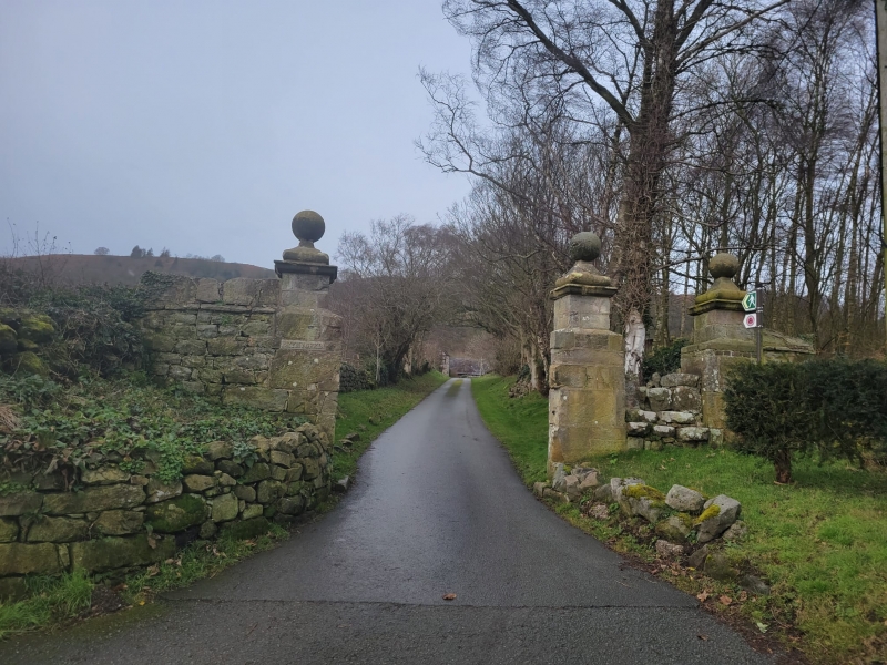
Location: Situated at the head of the drive which runs W to Bryn Iorcyn Manor House from Bryn Yorkin Road.
County: Flintshire
Community: Hope (Yr Hob)
Community: Llanfynydd
Locality: Bryn Iorcyn
Traditional County: Flintshire
Tagged with: Pier
Squared and coursed rubble gatepiers attached on each side to a ruinous stretch of rubble walling. The gatepiers are surmounted by plinths of smaller section supporting coped tops with ball finials.
C17 Stone piers at entrance of drive.
External links are from the relevant listing authority and, where applicable, Wikidata. Wikidata IDs may be related buildings as well as this specific building. If you want to add or update a link, you will need to do so by editing the Wikidata entry.


Other nearby listed buildings
