Approximate Location Map
Large Map »
Latitude: 52.137 / 52°8'13"N
Longitude: -4.6389 / 4°38'19"W
OS Eastings: 219500
OS Northings: 252025
OS Grid: SN195520
Mapcode National: GBR D0.7J0Q
Mapcode Global: VH2MH.JKZ5
Plus Code: 9C4Q49P6+QF
Entry Name: Churchyard of the Church of the Holy Cross
Listing Date: 6 March 1995
Last Amended: 6 March 1995
Grade: II
Source: Cadw
Source ID: 15867
Building Class: Religious, Ritual and Funerary
ID on this website: 300015867
Location: Situated above and some 125m NW of Mwnt beach under Foel y Mwnt.
County: Ceredigion
Community: Y Ferwig
Community: Y Ferwig
Locality: Mwnt
Traditional County: Cardiganshire
Tagged with: Churchyard Stone cross
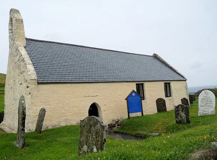
Churchyard of C13 church.
Rectangular church yard of C13 church surrounded by rubblestone based embankment eroded on N. Rendered outbuilding with imitation slate roof in SE corner. Entrance through two rounded and whitewashed rubblestone piers with iron spear-headed gate.
Listed for group value with Church of the Holy Cross.
External links are from the relevant listing authority and, where applicable, Wikidata. Wikidata IDs may be related buildings as well as this specific building. If you want to add or update a link, you will need to do so by editing the Wikidata entry.


Other nearby listed buildings
