Latitude: 53.1764 / 53°10'35"N
Longitude: -4.0576 / 4°3'27"W
OS Eastings: 262577
OS Northings: 366348
OS Grid: SH625663
Mapcode National: GBR 5S.3YN1
Mapcode Global: WH54G.NF06
Plus Code: 9C5Q5WGR+HX
Entry Name: Milestone by Bethesda Football Club
Listing Date: 25 April 1997
Last Amended: 25 April 1997
Grade: II
Source: Cadw
Source ID: 18379
Building Class: Transport
ID on this website: 300018379
Location: Situated some 300m S of centre of Bethesda near football club pavilion.
County: Gwynedd
Town: Bangor
Community: Bethesda
Community: Bethesda
Built-Up Area: Bethesda
Traditional County: Caernarfonshire
Tagged with: Milestone
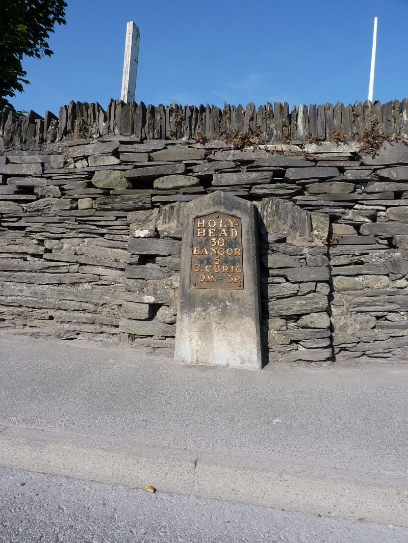
Following the Act of Union in 1801, a programme to improve the roads between the two capital cities of London and Dublin was initiated. In 1811 Thomas Telford was commissioned to undertake a survey of the roads between London and Holyhead and in 1817 began work on the northern stretch of the road at Shrewsbury. As well as overseeing the work, Thomas Telford also designed every detail of the road, and this milestone is one of a number designed for it. Milestones between Bangor and Cernioge were erected in the period between 1825 and February 1827.
Dressed Anglesey limestone slab, with shallow triangular head and raking chamfered sides. Cast iron inset plate, white lettering on black reading: HOLY- / HEAD / 30 / BANGOR / 5 / C. CURIG / 9M – 3F. Bench mark on stone below plate.
Set in front of a slate arch incorporated into a slate block boundary wall: an example of a “Telford Arch,” thought to have been designed to enhance and draw attention to the milestone.
Listed as a fine example of one of Telford's milestones retaining its cast iron plate.
External links are from the relevant listing authority and, where applicable, Wikidata. Wikidata IDs may be related buildings as well as this specific building. If you want to add or update a link, you will need to do so by editing the Wikidata entry.


Other nearby listed buildings