Approximate Location Map
Large Map »
Latitude: 52.4756 / 52°28'32"N
Longitude: -3.9046 / 3°54'16"W
OS Eastings: 270740
OS Northings: 288114
OS Grid: SN707881
Mapcode National: GBR 90.K19K
Mapcode Global: VH4F8.81PJ
Plus Code: 9C4RF3GW+65
Entry Name: Alltgochymynydd
Listing Date: 19 September 1997
Last Amended: 19 September 1997
Grade: II
Source: Cadw
Source ID: 18883
Building Class: Domestic
ID on this website: 300018883
Location: Situated towards E end of Cwm Tynant on N side of the valley, approached by long drive from road E of Bwlchglas Mine.
County: Ceredigion
Town: Aberystwyth
Community: Ceulanamaesmawr
Community: Ceulanamaesmawr
Locality: Cwm Tynant
Traditional County: Cardiganshire
Tagged with: Farmhouse
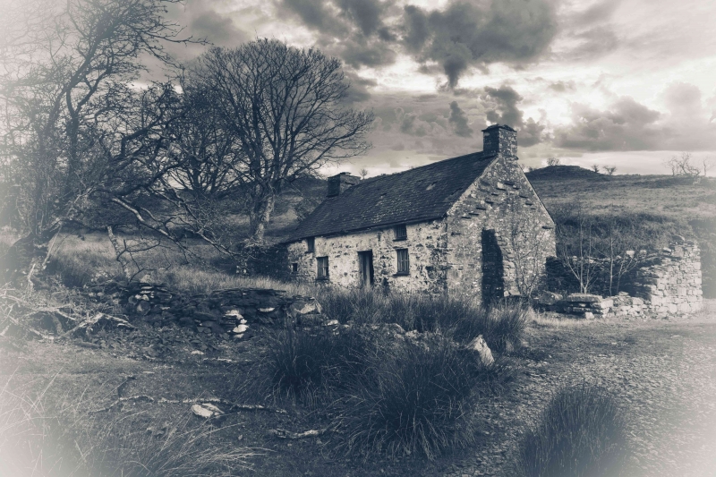
Possibly later C18 farmhouse, marked on 1847 Tithe Map as Alltgoch, owned by Evan Hughes and Jane James, occupied by Harry Harries.
Whitewashed rubble stone with steep-pitched slate roof, and stone end stacks, larger to left. Two-storey irregular long low front. Two-unit plan. Two widely separated first floor casement pairs under eaves. Ground floor casement pair to right aligned with window above, off-centre ledged door, casement pair, set to right of window above, and then very small fire-window. Stone slab lintels. Ruined stone outbuildings each end. Rear centre slated lean-to, no outshut.
One of the best examples of a traditional vernacular farmhouse in the region, still showing the irregular facade division and low upper floor.
External links are from the relevant listing authority and, where applicable, Wikidata. Wikidata IDs may be related buildings as well as this specific building. If you want to add or update a link, you will need to do so by editing the Wikidata entry.


Other nearby listed buildings
