Approximate Location Map
Large Map »
Latitude: 52.1645 / 52°9'52"N
Longitude: -3.7781 / 3°46'41"W
OS Eastings: 278477
OS Northings: 253296
OS Grid: SN784532
Mapcode National: GBR Y5.5TR7
Mapcode Global: VH5D4.GVJK
Plus Code: 9C4R567C+RQ
Entry Name: Outbuilding by Capel Soar and attached wall to W
Listing Date: 30 September 1997
Last Amended: 30 September 1997
Grade: II
Source: Cadw
Source ID: 18950
Building Class: Religious, Ritual and Funerary
ID on this website: 300018950
Location: Situated adjoining and at right angles to Capel Soar, backing onto graveyard.
County: Ceredigion
Community: Llanddewi Brefi (Llanddewibrefi)
Community: Llanddewi Brefi
Locality: Soar-y-Mynydd
Traditional County: Cardiganshire
Tagged with: Appendage
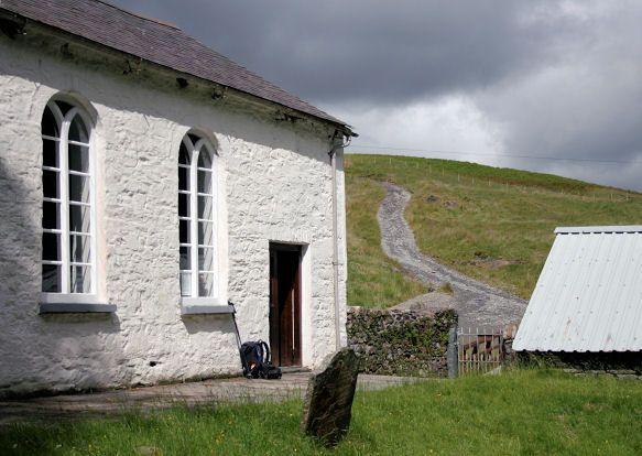
Outbuilding to Capel Soar originally built 1828, possibly a stable or loose-box.
Rubble stone with slates to N roof pitch, corrugated iron to S. N front has door, window, door, window, all with yellow brick cambered heads. Ledged doors. Attached to right end is curving rubble stone wall extending around rear of Capel Soar and the chapel house, interrupted for one gate close to outbuilding.
Divided into two sections by rubble wall up to wall-plate height. Later C19 collar-truss roof.
Listed for group value with Capel Soar, enclosing one side of the grassed graveyard in front of the chapel.
External links are from the relevant listing authority and, where applicable, Wikidata. Wikidata IDs may be related buildings as well as this specific building. If you want to add or update a link, you will need to do so by editing the Wikidata entry.


Other nearby listed buildings
