Latitude: 51.5323 / 51°31'56"N
Longitude: -3.5907 / 3°35'26"W
OS Eastings: 289758
OS Northings: 182685
OS Grid: SS897826
Mapcode National: GBR HC.GRK2
Mapcode Global: VH5HB.QR37
Plus Code: 9C3RGCJ5+WP
Entry Name: Tynygarn Mile marker
Listing Date: 13 November 1997
Grade: II
Source: Cadw
Source ID: 19052
Building Class: Transport
ID on this website: 300019052
Location: Located on W side of A4063 (Bridgend Road) opposite a junction with a minor road to Glan Rhyd Bridge.
County: Bridgend
Community: Newcastle Higher (Y Castellnewydd)
Community: Newcastle Higher
Locality: Glan Rhyd
Built-Up Area: Bridgend
Traditional County: Glamorgan
Tagged with: Architectural structure
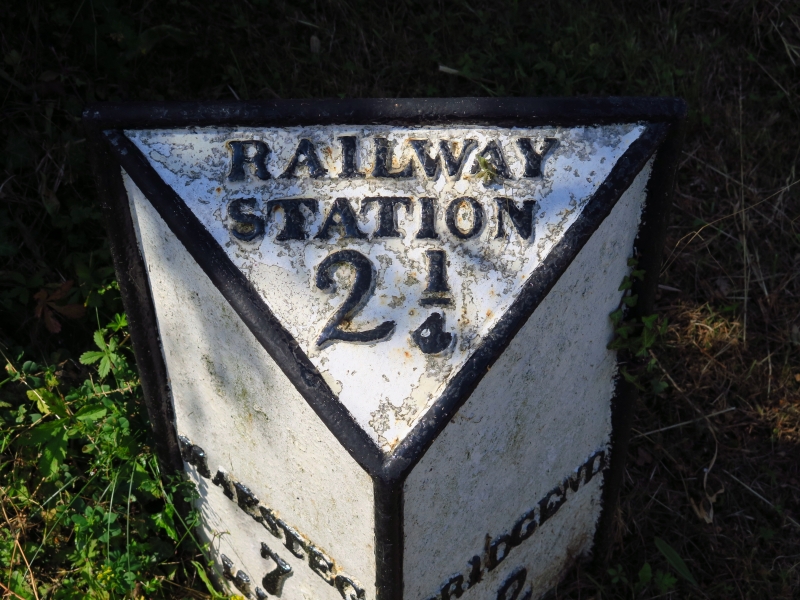
Mid C19 cast iron mile marker of triangular shape with sloping top. Painted white with black lettering in relief:
RAILWAY
STATION
2 1/4
MAESTEG BRIDGEND
7 2
MILES MILES
A well detailed Victorian mile marker associated with the South Wales Railway.
External links are from the relevant listing authority and, where applicable, Wikidata. Wikidata IDs may be related buildings as well as this specific building. If you want to add or update a link, you will need to do so by editing the Wikidata entry.


Other nearby listed buildings