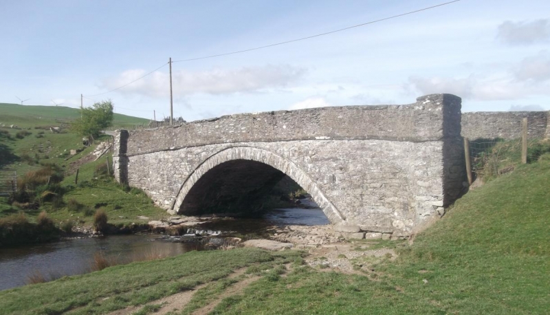
Pont Tai'n-rhos, aka Pont-yr-ebach (partly in Cerrigydrudion Community)
A Grade II Listed Building in Llangwm, Conwy
Coordinates
Latitude: 53.0147 / 53°0'53"N
Longitude: -3.5726 / 3°34'21"W
OS Eastings: 294598
OS Northings: 347537
OS Grid: SH945475
Mapcode National: GBR 6F.G2N9
Mapcode Global: WH66M.3H16
Plus Code: 9C5R2C7G+VX
Entry Name: Pont Tai'n-rhos, aka Pont-yr-ebach (partly in Cerrigydrudion Community)
Listing Date: 17 February 1998
Grade: II
Source: Cadw
Source ID: 19604
Building Class: Transport
ID on this website: 300019604
Location: The bridge carries the road from Llangwm to Cerrigydrudion over the Afon Ceirw, on the northern boundary of the community.
County: Conwy
Community: Llangwm
Community: Llangwm
Locality: Arddwyfaen
Traditional County: Denbighshire
Tagged with:
Bridge
Exterior
See Record no 19349 in Cerrigydrudion community for full description of this bridge.
External Links
External links are from the relevant listing authority and, where applicable, Wikidata.
Wikidata IDs may be related buildings as well as this specific building. If you want to add or update a link, you
will need to do so by editing the Wikidata entry.
Recommended Books
Other nearby listed buildings
-
II
Pont Tai'n-rhos, also known as Pont yr Ebach, (partly in Llangwm Community)
The bridge carries the road from Cerrigydrudion to the SW, over the Afon Ceirw, on the southern boundary of the community.
-
II*
Llaethwryd
The large farm is located S of the Holyhead Road, between the Cwm-penanner road and the minor road running S, and approximately 1400m SW of the village centre.
-
II
Building at right angles to the farmhouse at Llaethwryd
The building is attached at its S corner to the N corner of Llaethwryd main farmhouse, and extends at right angles to enclose the main front forecourt at the farm.
-
II
Cartshed and Stabling SW of Llaethwryd
The cartshed stands parallel and at the rear of Llaethwryd farmhouse, on the SW side.
-
II
Barn in the outer yard SW of Llaethwryd
The barn is located at right angles to the previous barn, and W of the cartshed; to SW of the farmhouse.
-
II
Barn N of the cartshed at Llaethwryd
This is the main barn at Llaethwryd and stands E of the farmhouse, at right angles to the second barn, the E yard enclosed by a 2-bay storehouse and a dog house.
-
II
Pont Moelfre
The bridge is located just off the A5 Holyhead Road, and carries the A4501 to Bala over the Afon Ceirw.
-
II
Pont Ty'n-y-rhyd
The bridge carries the minor road to the Cwm Penanner over the Afon Nug, 350m SW of the village centre.