Approximate Location Map
Large Map »
Latitude: 51.5963 / 51°35'46"N
Longitude: -3.0129 / 3°0'46"W
OS Eastings: 329932
OS Northings: 189093
OS Grid: ST299890
Mapcode National: GBR J5.BLTM
Mapcode Global: VH7BC.Q4JL
Plus Code: 9C3RHXWP+GR
Entry Name: Waen Lock, Monmouthshire and Brecon Canal
Listing Date: 14 September 1999
Last Amended: 14 September 1999
Grade: II
Source: Cadw
Source ID: 22331
Building Class: Transport
ID on this website: 300022331
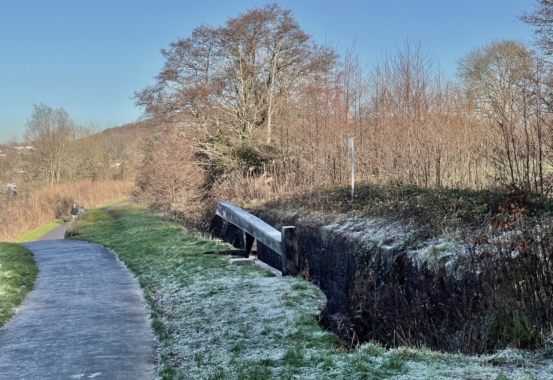
Location: Isolated location. Situated approximately 150 metres NE of Dock Lock.
County: Newport
Community: Allt-yr-yn (Allt-yr-ynn)
Community: Allt-yr-Yn
Locality: Allt-yr-yn
Built-Up Area: Newport
Traditional County: Monmouthshire
Tagged with: Lock
The eastern branch of the Monmouthshire and Brecon Canal was authorised by Act of Parliament in 1792, and officially opened in 1799. It ran from Newport to Pontnewynydd, and was engineered by Thomas Dadford Jnr. The canal connected with several tramroads belonging to the same company (Monmouthshire Canal Navigational Company), carrying coal down to the wharves. The branch was 17.7 km long, and rose 136.2 metres through 42 locks. The contemporary western branch, 19 km long, ran to Crumlin. In 1812, the eastern branch was connected to the Brecon and Abergavenny Canal at Pontymoile Basin, and this became the main line. In 1853-55, the Monmouthshire Railway and Canal Company built a railway down to Newport, the company amalgamating with the Great Western Railway in 1880. The canal then became increasingly disused. The Crumlin branch closed in 1949, the main line in 1962.
Lock chamber of brick construction with intermittent ashlar blocks; tooled sandstone copings (some missing) and quoins. Rebate for removed lock gate to NE. with splayed rubble retaining walls for some 10 metres beyond; stone copings. Deep overflow ditch on SE side. Rubble weir at SW end, with splayed retaining walls beyond.
Listed as a significant element of the engineering works associated with the Monmouthshire and Brecon Canal.
External links are from the relevant listing authority and, where applicable, Wikidata. Wikidata IDs may be related buildings as well as this specific building. If you want to add or update a link, you will need to do so by editing the Wikidata entry.


Other nearby listed buildings
