Approximate Location Map
Large Map »
Latitude: 52.6968 / 52°41'48"N
Longitude: -3.6593 / 3°39'33"W
OS Eastings: 287964
OS Northings: 312309
OS Grid: SH879123
Mapcode National: GBR 9B.31PT
Mapcode Global: WH683.RGPW
Plus Code: 9C4RM8WR+P7
Entry Name: Gweinion
Listing Date: 4 November 1999
Last Amended: 4 November 1999
Grade: II
Source: Cadw
Source ID: 22605
Building Class: Domestic
ID on this website: 300022605
Location: The farm is reached by a long roadway commencing from the N side of the A 458 near the roundabout junction with the A470, and running E along the S side of the Cwm Cleifion.
County: Gwynedd
Town: Machynlleth
Community: Mawddwy
Community: Mawddwy
Locality: Mallwyd
Traditional County: Merionethshire
Tagged with: Farmhouse
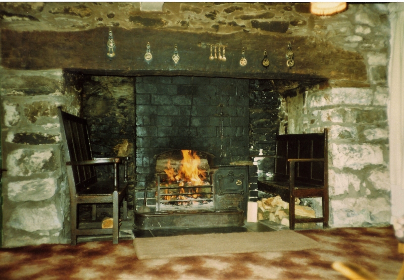
The farmhouse was probably built in the C18 as a simple 2-room dwelling consisting of a hall-kitchen at the N end with entrance against the gable stack, and farm buildings extending uphill in line. This was extended on the N end by a further bay, perhaps late C18 or early C19.
Built of local stone rubble, with a slate roof. 6-panelled door opposite the original gable end stack, and 2-light casement windows with small panes, three on each floor, horizontally proportioned on the ground floor, vertically above. A cellar exists below the inner room. Three stone stacks, with drip courses. The farm range is weatherboarded above stone, and has a corrugated iron roof.
Not accessible at the time of inspection.
Included as a good example of an C18 farmhouse of traditional form, fronting a large triangular farmyard. Of group value in its fine setting with its farm building.
External links are from the relevant listing authority and, where applicable, Wikidata. Wikidata IDs may be related buildings as well as this specific building. If you want to add or update a link, you will need to do so by editing the Wikidata entry.


Other nearby listed buildings
