Approximate Location Map
Large Map »
Latitude: 51.5995 / 51°35'58"N
Longitude: -4.2706 / 4°16'14"W
OS Eastings: 242836
OS Northings: 191401
OS Grid: SS428914
Mapcode National: GBR GQ.L3L9
Mapcode Global: VH3MV.X2N5
Plus Code: 9C3QHPXH+QQ
Entry Name: Barn attached to Church with Roadside Range
Listing Date: 3 March 2000
Last Amended: 3 March 2000
Grade: II
Source: Cadw
Source ID: 22879
Building Class: Agriculture and Subsistence
ID on this website: 300022879
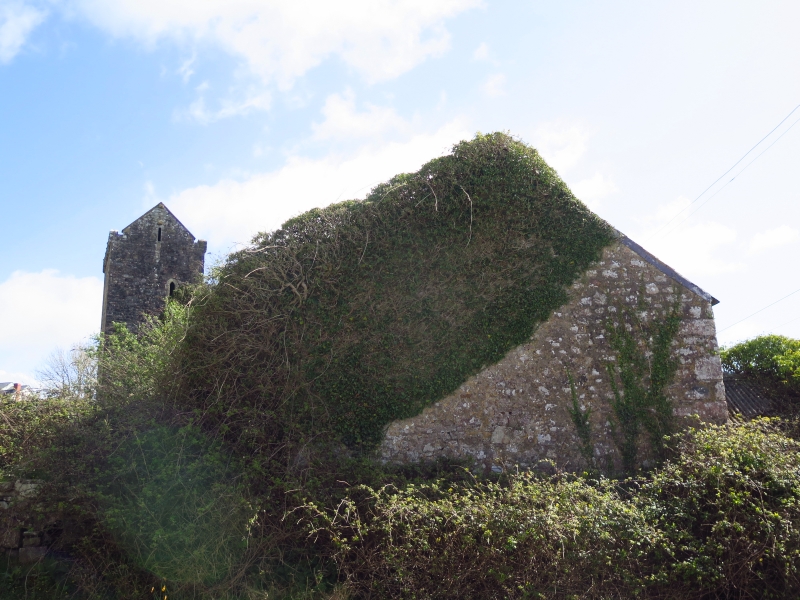
Location: Attached to St Cenydd's Church at the west of the nave.
County: Swansea
Town: Swansea
Community: Llangennith, Llanmadoc and Cheriton (Llangynydd, Llanmadog a Cheriton)
Community: Llangennith, Llanmadoc and Cheriton
Locality: Llangennith village
Traditional County: Glamorgan
Tagged with: Barn
Traditionally known as 'the parson's barn'. The barn is probably C18 or earlier, but lacking in datable features; it was probably for the storage of tithes. The lower building fronting the street attached to the corner of the barn is at least partly built up from a low roadside wall in the C19, part earlier.
The barn and other college buildings were part of the Rectorial Glebe, owned by All Souls College, Oxford, until sold with the church to Major Penrice in 1838; in 1844 they were in the tenancy of Mary Jenkin. The Major's nephew sold them off as farm property in 1883 when the church was given to the parishioners.
A barn extending west from the nave of the church in identical local conglomerate sandstone masonry. Slate roof with tile ridge; three rooflights inserted in south slope. Door openings to the south. One small window to the north. Lower range extends south from the end of the barn, at the side of a small farmyard. The latter range has blank walls to the street in identical masonry.
Listed as a barn in an exceptional position attached to the west end of the church, and for group value with St Cenydd's church.
External links are from the relevant listing authority and, where applicable, Wikidata. Wikidata IDs may be related buildings as well as this specific building. If you want to add or update a link, you will need to do so by editing the Wikidata entry.


Other nearby listed buildings
