Approximate Location Map
Large Map »
Latitude: 52.9205 / 52°55'13"N
Longitude: -3.5154 / 3°30'55"W
OS Eastings: 298214
OS Northings: 336972
OS Grid: SH982369
Mapcode National: GBR 6H.N4KV
Mapcode Global: WH670.ZV6G
Plus Code: 9C4RWFCM+5V
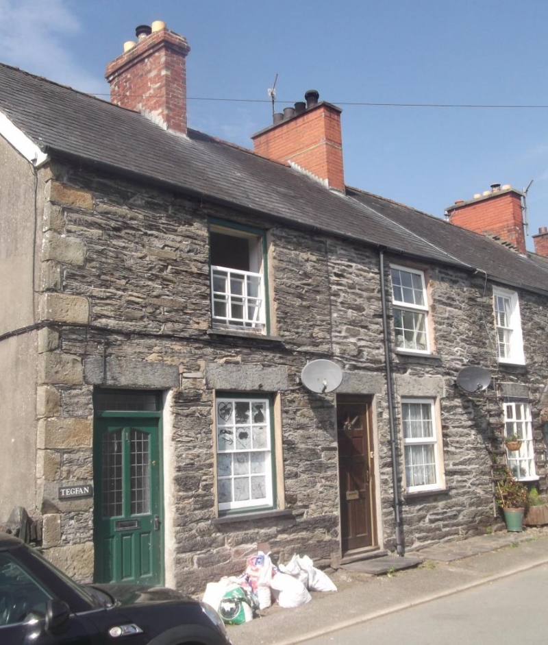
Entry Name: Tegfan
Listing Date: 31 January 2001
Last Amended: 31 January 2001
Grade: II
Source: Cadw
Source ID: 24598
Building Class: Domestic
ID on this website: 300024598
Location: On the street-line at the southern end of the village.
County: Gwynedd
Town: Bala
Community: Llandderfel
Community: Llandderfel
Traditional County: Merionethshire
Tagged with: Architectural structure
Mid Victorian terrace of workers' cottages.
The interior was not inspected at the time of survey.
Listed as part of a second-half C19 terrace retaining good original external character in an attractive village centre.
Group value with other listed items in and around Church Street.
External links are from the relevant listing authority and, where applicable, Wikidata. Wikidata IDs may be related buildings as well as this specific building. If you want to add or update a link, you will need to do so by editing the Wikidata entry.


Other nearby listed buildings
