Approximate Location Map
Large Map »
Latitude: 51.6706 / 51°40'14"N
Longitude: -4.6989 / 4°41'56"W
OS Eastings: 213465
OS Northings: 200319
OS Grid: SN134003
Mapcode National: GBR GF.7Y7S
Mapcode Global: VH2PS.H8QN
Plus Code: 9C3QM8C2+6C
Entry Name: Battersea House
Listing Date: 28 March 2002
Last Amended: 28 March 2002
Grade: II
Source: Cadw
Source ID: 26420
Building Class: Domestic
ID on this website: 300026420
Location: On the W side of St Mary's Street some 55m N of the junction with the Paragon.
County: Pembrokeshire
Town: Tenby
Community: Tenby (Dinbych-y-pysgod)
Community: Tenby
Built-Up Area: Tenby
Traditional County: Pembrokeshire
Tagged with: House
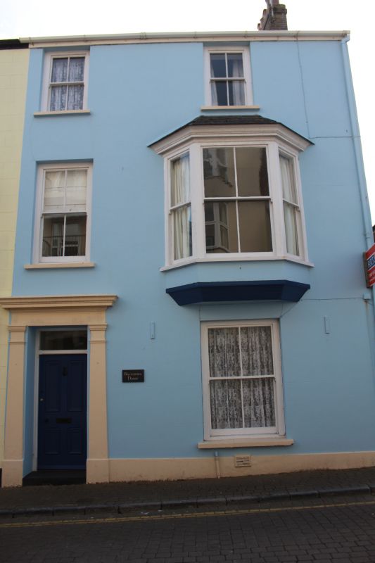
House of the 1870s, similar to, but smaller than Myrtle House adjoining. Probably built by Wm Davies of Tenby, builder (cf detail in Victoria Street).
House, painted stucco and slate roof with right end brick stack. Three-storeys, two-window range offset to left. Four-pane sashes, top floor sashes shorter than those on Myrtle House, and under eaves. First floor right large canted oriel window with 2-4-3-pane glazing, hipped slate roof and chamfered base. Door to left in stucco pilastered doorcase with entablature and cornice. 4-panel door and overlight, in chamfered and stopped surrounds.
Included with Myrtle House as good later C19 pair of houses with surviving detail
External links are from the relevant listing authority and, where applicable, Wikidata. Wikidata IDs may be related buildings as well as this specific building. If you want to add or update a link, you will need to do so by editing the Wikidata entry.


Other nearby listed buildings
