Approximate Location Map
Large Map »
Latitude: 52.3332 / 52°19'59"N
Longitude: -3.9296 / 3°55'46"W
OS Eastings: 268619
OS Northings: 272323
OS Grid: SN686723
Mapcode National: GBR 8Z.V140
Mapcode Global: VH4FT.TMY6
Plus Code: 9C4R83MC+75
Entry Name: Llanafan Womens Institute Hall
Listing Date: 31 March 2004
Last Amended: 31 March 2004
Grade: II
Source: Cadw
Source ID: 82656
Building Class: Domestic
ID on this website: 300082656
Location: Situated some 250m NE of Llanafan church on N side of lane, approached by footbridge over Nant Pantyrhaidd.
County: Ceredigion
Town: Aberystwyth
Community: Trawsgoed
Community: Trawsgoed
Locality: Llanafan
Traditional County: Cardiganshire
Tagged with: Cottage
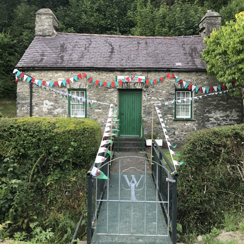
Single-storey cottage said to date from 1832. It was called Bronheulog and was given by the Countess of Lisburne to the Womens Institute as a meeting room in 1918. Also known as Ty Bach Twt. Restored 1986. An old photograph shows the house with pretty wire-work piers and arch in front, the building whitewashed with 2 colours to the voussoirs and small slates to the roof.
Meeting hall, former cottage, rubble stone with slate roof and stone end stacks with dripstones. Single storey double-fronted cottage with narrow 12-pane sash each side of framed board door, all with stone voussoirs to heads, stone sills to windows. Painted board over door 'Llanafan Women's Institute'. Blocked loft light in right end wall, with stone voussoirs.
Not inspected at time of survey.
Included as a good example of the small single-storey cottages of the region, little altered. Of historical interest as a very early W.I. hall, and for connection to the Trawsgoed estate.
External links are from the relevant listing authority and, where applicable, Wikidata. Wikidata IDs may be related buildings as well as this specific building. If you want to add or update a link, you will need to do so by editing the Wikidata entry.


Other nearby listed buildings
