Approximate Location Map
Large Map »
Latitude: 52.5405 / 52°32'25"N
Longitude: -3.9396 / 3°56'22"W
OS Eastings: 268557
OS Northings: 295391
OS Grid: SN685953
Mapcode National: GBR 8Y.F4MZ
Mapcode Global: VH4DV.NDPT
Plus Code: 9C4RG3R6+55
Entry Name: Milestone to S of Eglwys Fach
Listing Date: 23 November 2004
Last Amended: 23 November 2004
Grade: II
Source: Cadw
Source ID: 83265
Building Class: Transport
ID on this website: 300083265
Location: Situated some 100m SSW of lychgate to churchyard.
County: Ceredigion
Town: Machynlleth
Community: Ysgubor-y-coed
Community: Ysgubor-y-Coed
Locality: Eglwys Fach
Traditional County: Cardiganshire
Tagged with: Milestone
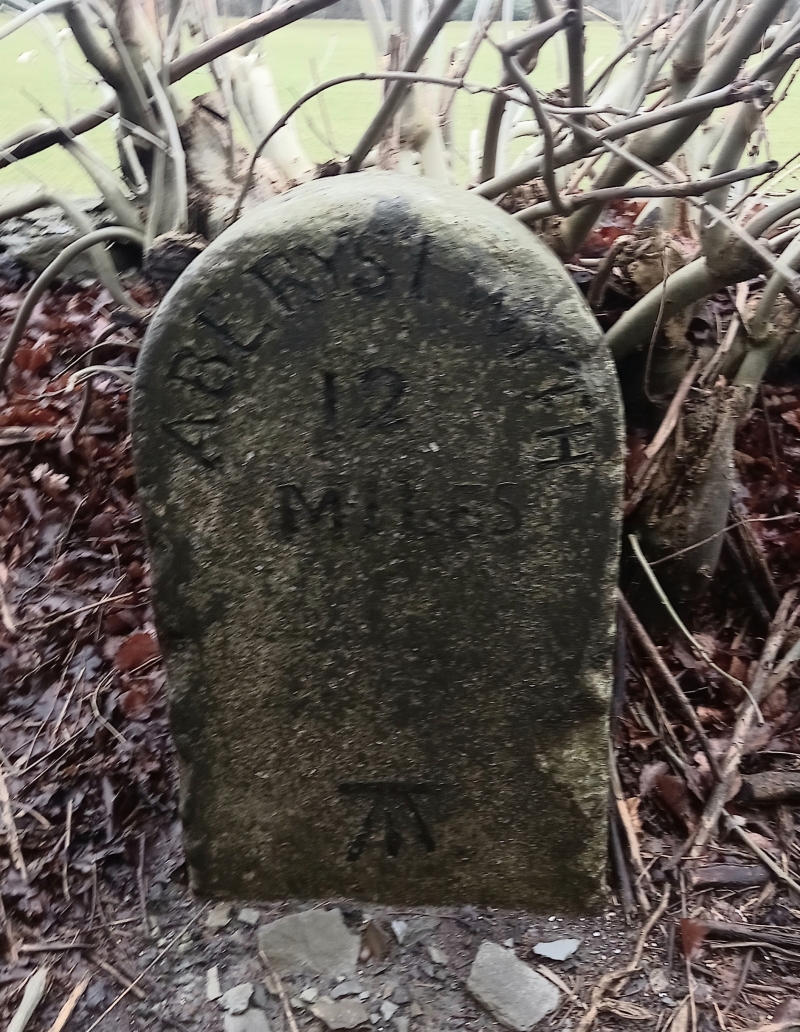
C19 milestone on main coast road. Turnpike trust established 1770, road to Machynlleth improved in 1780s. There was a toll-gate at Garreg.
Milestone, whitewashed stone, round-headed with 'Aberystwyth 12 Miles' (19.32km) in C19 capital letters. Benchmark added.
Included for its historical interest as a C19 milestone on this former turnpike road.
External links are from the relevant listing authority and, where applicable, Wikidata. Wikidata IDs may be related buildings as well as this specific building. If you want to add or update a link, you will need to do so by editing the Wikidata entry.


Other nearby listed buildings
