History in Structure

Ysgoldy y Banc

A Grade II Listed Building in Ysbyty Ystwyth, Ceredigion

More Photos »
Approximate Location Map
Large Map »

Coordinates

Latitude: 52.3285 / 52°19'42"N

Longitude: -3.8341 / 3°50'2"W

OS Eastings: 275110

OS Northings: 271630

OS Grid: SN751716

Mapcode National: GBR 93.VDMY

Mapcode Global: VH4FW.HQFT

Plus Code: 9C4R85H8+C9

Entry Name: Ysgoldy y Banc

Listing Date: 23 December 2004

Last Amended: 23 December 2004

Grade: II

Source: Cadw

Source ID: 83425

Building Class: Education

ID on this website: 300083425

Location: Situated some 2 km E of Ysbyty Ystwyth, next to Pantyffynnon.

County: Ceredigion

Town: Ystrad Meurig

Community: Ysbyty Ystwyth

Community: Ysbyty Ystwyth

Traditional County: Cardiganshire

Tagged with: School building

Find accommodation in
Pont-rhyd-y-groes

History

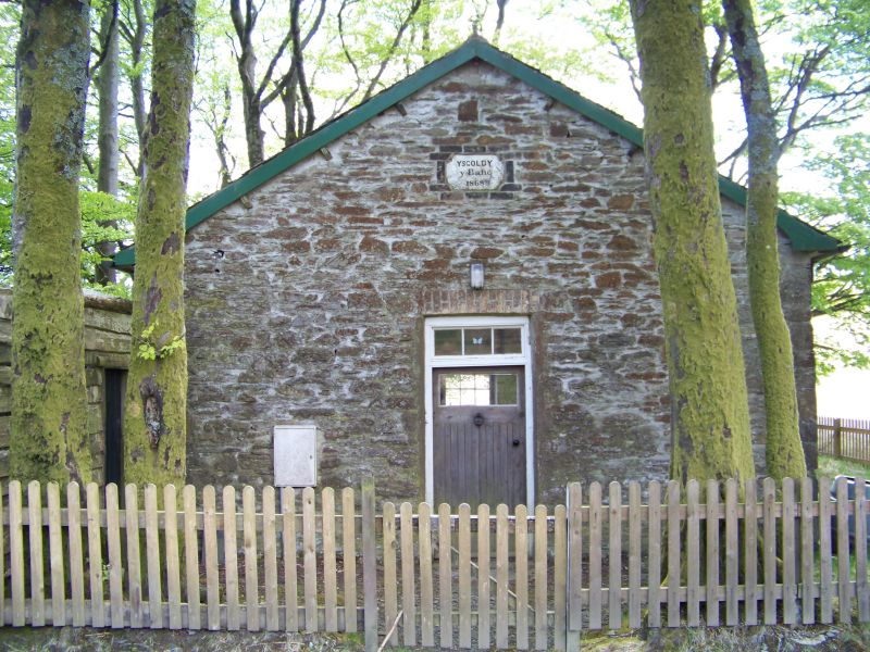
Small schoolhouse built in 1868, probably associated with the lead-mining community.

Exterior

Former school, rubble stone with slate eaves roof. Single storey. Front has plaque 'Ysgoldy y Banc 1868' in gable and narrow door with overlight and yellow brick head. Sides each have two elongated twelve-pane horned sash windows with C20 external shutters, and S end has one. Brick heads, slate sills. Roof of small slates.

Interior

Not inspected.

Reasons for Listing

Included as a rare surviving example of a simple rural school-room, in the context of a scattered lead mining settlement now largely lost.

External Links

External links are from the relevant listing authority and, where applicable, Wikidata. Wikidata IDs may be related buildings as well as this specific building. If you want to add or update a link, you will need to do so by editing the Wikidata entry.

Recommended Books

Other nearby listed buildings

  • II Former cottage and outbuilding at Storehouse farm
    Situated in farm yard at right angles to farmhouse, at end of lane running E some 1.2 km from village.
  • II Cottage to SE of Pantyrhedyn
    Situated some 800m E of village, on track to Pantyrhedyn running N from lane to Storehouse farm.
  • II Ty Coch
    Situated 300m E of Storehouse, but approached from forestry roads past Hafod, over Ystwyth, then up track running ESE some 1.2 km.
  • II Bronheulog
    Situated some 200m S of the Old Post Office, facing rear of Gwynfryn/Isfryn, on the Lefel Fawr mine-working site.
  • II Entrance arch to the Lefel Fawr
    Situated in embankment that carries the main road some 15m SE of Gwynfryn & Isfryn, about 200m S of the Old Post Office
  • II Gwynfryn and Isfryn
    Situated some 170m S of the Old Post Office, backing onto road where it bends around the Lefel Fawr mine site.
  • II Bronygraig
    Situated on terrace overlooking B4343, behind the Old Post Office on lane to Capel Bethel.
  • II Lisburne House
    Situated some 250m SSW of Old Post Office, below main village road, on lane to Llanafan, opposite Lisburne Garage.

BritishListedBuildings.co.uk is an independent online resource and is not associated with any government department. All government data published here is used under licence. Please do not contact BritishListedBuildings.co.uk for any queries related to any individual listed building, planning permission related to listed buildings or the listing process itself.

British Listed Buildings is a Good Stuff website.