Approximate Location Map
Large Map »
Latitude: 52.3776 / 52°22'39"N
Longitude: -3.8757 / 3°52'32"W
OS Eastings: 272417
OS Northings: 277159
OS Grid: SN724771
Mapcode National: GBR 91.R8DT
Mapcode Global: VH4FN.RHYQ
Plus Code: 9C4R94HF+2P
Entry Name: Hafod-y-coed
Listing Date: 16 March 2005
Last Amended: 16 March 2005
Grade: II
Source: Cadw
Source ID: 84257
Building Class: Domestic
ID on this website: 300084257
Location: On the N side of the A4120 some 1.7km W of the bridge over the Afon Mynach.
County: Ceredigion
Town: Aberystwyth
Community: Pontarfynach
Community: Pontarfynach
Traditional County: Cardiganshire
Tagged with: Cottage
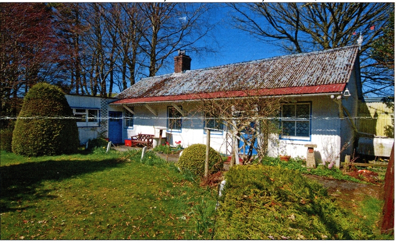
Corrugated-iron clad timber-framed bungalow probably of the 1930s. Said to have been built by a local carpenter, leased and later sold to the present (2004) owner in 1960s, who changed name from The Bungalow.
Cottage, painted corrugated-iron on timber frame, with similar roof, and brick ridge chimney, set to left of centre. Single-storey, with overhanging front awning supported on timber raking brackets. Zig-zag timber eaves to awning with pierced hole in each board. Front of six bays with horned 4-pane sash windows. Door to left (within later addition), then sash, then two sashes, a half-glazed door and a final sash. Windowless right end. Attached at left corner is addition at right angles with triple casement and half-glazed door facing E.
Interior said to be boarded throughout.
Included as an exceptionally well preserved example of the corrugated-iron cottages of the earlier C20, once common, now rare.
External links are from the relevant listing authority and, where applicable, Wikidata. Wikidata IDs may be related buildings as well as this specific building. If you want to add or update a link, you will need to do so by editing the Wikidata entry.


Other nearby listed buildings
