Approximate Location Map
Large Map »
Latitude: 51.8125 / 51°48'44"N
Longitude: -2.7139 / 2°42'50"W
OS Eastings: 350880
OS Northings: 212891
OS Grid: SO508128
Mapcode National: GBR FL.X1F5
Mapcode Global: VH86T.XP4X
Plus Code: 9C3VR76P+XC
Entry Name: 9, St. Mary's Street
Listing Date: 10 August 2005
Last Amended: 10 August 2005
Grade: II
Source: Cadw
Source ID: 85176
ID on this website: 300085176
Location: At the bend in the road part way along this varied residential street leading south-east from the parish church.
County: Monmouthshire
Town: Monmouth
Community: Monmouth (Trefynwy)
Community: Monmouth
Built-Up Area: Monmouth
Traditional County: Monmouthshire
Tagged with: Building
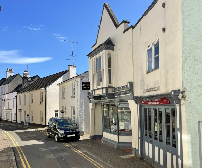
Late C19, possibly 1890s, shop premises, which has been very little altered.
Smooth rendered and painted to street, rough rendered to left return, roof not visible from street. Single bay property, gable end to street. Two storeys, one window. The ground floor has a central canted shopfront with 4-light display windows with slim timber mullions, house entry to left and shop door to right, part-glazed doors with transom lights. Elaborate fascia carried on quoin pilasters with shaped brackets. The fascia has a triple frieze of scallops, hounds teeth and acroterion type embellishments with trefoil decoration. The centre of the fascia carries an oriel window with panelled apron and 2 over 2 pane sash flanked by narrow 1 over 1s with another on each return, moulded cornice and tented roof. Steeply pitched gable with two crow-steps on either side.
Plain shop premises.
Included for its special architectural interest as a probably 1890s shop with an elaborate and well preserved shopfront of definite quality and character.
External links are from the relevant listing authority and, where applicable, Wikidata. Wikidata IDs may be related buildings as well as this specific building. If you want to add or update a link, you will need to do so by editing the Wikidata entry.


Other nearby listed buildings
