Approximate Location Map
Large Map »
Latitude: 52.9395 / 52°56'22"N
Longitude: -4.1412 / 4°8'28"W
OS Eastings: 256207
OS Northings: 340157
OS Grid: SH562401
Mapcode National: GBR 5P.LVXT
Mapcode Global: WH55L.CC8V
Plus Code: 9C4QWVQ5+QG
Entry Name: Union Inn
Listing Date: 30 March 1951
Last Amended: 26 September 2005
Grade: II
Source: Cadw
Source ID: 85348
Also known as: The Union Inn
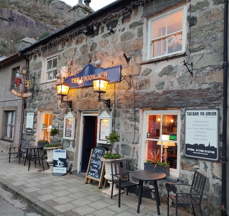
The Union Inn, Porthmadog
ID on this website: 300085348
Location: A terraced house on the E side of Market Square.
County: Gwynedd
Community: Porthmadog
Community: Porthmadog
Locality: Tremadog
Traditional County: Caernarfonshire
Tagged with: Pub Terrace house
Tremadog was a town created by William Madocks (1773-1828) in the first decade of the C19 on reclaimed land known as Traeth Mawr, the estuary of Afon Glaslyn. It was originally intended to be a post town on a direct road between London and Dublin, via Porthdinllaen on the Lleyn peninsula, a project that in due course lost out to the Holyhead Road. Tremadog was laid out around a market square, with market hall, coaching inn, houses and shops, with a church and chapel just outside the centre. Building of this small planned development, as well as a separate woollen manufactory, began c1805 and was largely completed by the time Richard Colt Hoare described it in 1810. No 7 Market Square was part of this first phase of development. It was known as the Union Inn from at least 1868.
A 2-storey double-fronted public house of roughly coursed and squared quarried stone with large lintels, slate roof on slated projecting eaves, and stone end stacks. Its central entrance has fielded-panel doors under a thin overlight. Windows are 4-pane horned sashes, shorter in the upper storey.
Not inspected.
Listed for its special architectural interest as a public house, part of the original development of Tremadog, using local stone and retaining definite C19 character and detail. An integral component of the planned town.
External links are from the relevant listing authority and, where applicable, Wikidata. Wikidata IDs may be related buildings as well as this specific building. If you want to add or update a link, you will need to do so by editing the Wikidata entry.


Other nearby listed buildings
