Approximate Location Map
Large Map »
Latitude: 51.9448 / 51°56'41"N
Longitude: -3.3853 / 3°23'7"W
OS Eastings: 304874
OS Northings: 228276
OS Grid: SO048282
Mapcode National: GBR YP.MNWS
Mapcode Global: VH6BZ.8CNY
Plus Code: 9C3RWJV7+WV
Entry Name: 12, The Watton
Listing Date: 16 December 1976
Last Amended: 4 November 2005
Grade: II
Source: Cadw
Source ID: 85611
ID on this website: 300085611
Location: Roughly opposite Gasworks Lane
County: Powys
Town: Brecon
Community: Brecon (Aberhonddu)
Community: Brecon
Built-Up Area: Brecon
Traditional County: Brecknockshire
Tagged with: Building
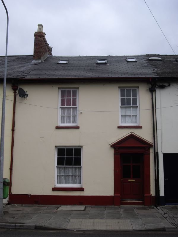
Part of an early to mid C19 terrace.
No.12 has 2-window front with 12-pane hornless sashes on first floor, and similar (broader) window to L on ground floor; doorway to R has square headed pedimented doorcase, and part-glazed panelled door. Small roof lights.
One of six well-preserved early C19 houses retaining overall late Georgian character. Group value both with rest of the terrace and with other listed buildings in The Watton.
External links are from the relevant listing authority and, where applicable, Wikidata. Wikidata IDs may be related buildings as well as this specific building. If you want to add or update a link, you will need to do so by editing the Wikidata entry.


Other nearby listed buildings
