Latitude: 51.9448 / 51°56'41"N
Longitude: -3.386 / 3°23'9"W
OS Eastings: 304827
OS Northings: 228279
OS Grid: SO048282
Mapcode National: GBR YP.MNQ9
Mapcode Global: VH6BZ.8C9X
Plus Code: 9C3RWJV7+WH
Entry Name: 60, The Watton
Listing Date: 16 December 1976
Last Amended: 4 November 2005
Grade: II
Source: Cadw
Source ID: 85700
ID on this website: 300085700
Location: Between Conway Terrace and Gasworks Lane.
County: Powys
Town: Brecon
Community: Brecon (Aberhonddu)
Community: Brecon
Built-Up Area: Brecon
Traditional County: Brecknockshire
Tagged with: Building
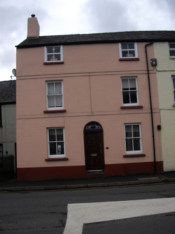
Early to mid C19 group of 4 houses with unusual plan. Entrance to No.61 in wall of passage through No.62.
Nos.60 and 61 with street front of two bays and central doorway. Roughcast; cement rendered bands at second and first floor levels and plinth. Modern glazing on second floor; 4-pane sashes on first and ground floors. Plain round-headed doorway with modern six-panelled door; blocked semi-circular tympanum.
Included for group value with the other listed buildings in The Watton.
External links are from the relevant listing authority and, where applicable, Wikidata. Wikidata IDs may be related buildings as well as this specific building. If you want to add or update a link, you will need to do so by editing the Wikidata entry.


Other nearby listed buildings