Approximate Location Map
Large Map »
Latitude: 51.9522 / 51°57'7"N
Longitude: -3.3885 / 3°23'18"W
OS Eastings: 304672
OS Northings: 229100
OS Grid: SO046291
Mapcode National: GBR YP.M249
Mapcode Global: VH6BZ.66Z8
Plus Code: 9C3RXJ26+VH
Entry Name: 73/74
Listing Date: 16 December 1976
Last Amended: 4 November 2005
Grade: II
Source: Cadw
Source ID: 85716
ID on this website: 300085716
Location: At the end of the building line on this side of The Struet.
County: Powys
Town: Brecon
Community: Brecon (Aberhonddu)
Community: Brecon
Built-Up Area: Brecon
Traditional County: Brecknockshire
Tagged with: Building
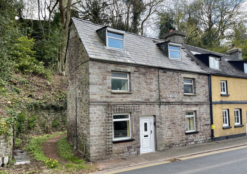
Nos.73 and 74 faced with small blocks of stone laid in regular courses. Two dormers, with modern glazing. Modern top-hung casements at either end on both first and ground floors; two doorways with dressed stone heads, right hand one now blocked and left hand one with modern door.
Group of houses with C18 origins with Group Value with other listed buildings in The Struet.
External links are from the relevant listing authority and, where applicable, Wikidata. Wikidata IDs may be related buildings as well as this specific building. If you want to add or update a link, you will need to do so by editing the Wikidata entry.


Other nearby listed buildings
