Approximate Location Map
Large Map »
Latitude: 52.952 / 52°57'7"N
Longitude: -2.8133 / 2°48'47"W
OS Eastings: 345453
OS Northings: 339716
OS Grid: SJ454397
Mapcode National: GBR 7F.L13M
Mapcode Global: WH89M.R2J7
Plus Code: 9C4VX52P+RM
Entry Name: Sundial in Hanmer churchyard
Listing Date: 15 November 2005
Last Amended: 15 November 2005
Grade: II
Source: Cadw
Source ID: 86931
ID on this website: 300086931
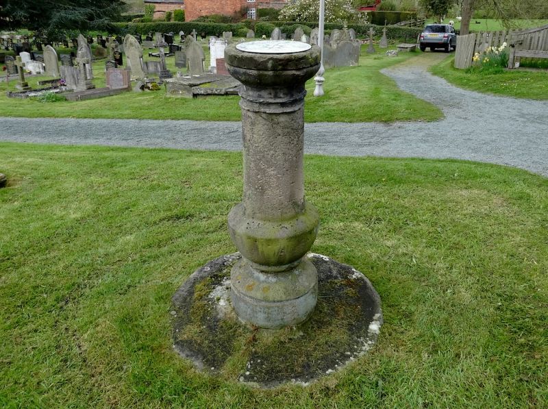
Location: In the churchyard SE of the porch.
County: Wrexham
Community: Hanmer
Community: Hanmer
Traditional County: Flintshire
Tagged with: Sundial
Dated 1821. The sundial is shown in its present position on the 1873 Ordnance Survey.
A baluster-shaped freestone pedestal with plate. The plate, by Dollond of London, includes the inscription 'Thomas South, Richard Hinton Churchwardens 1821'. The gnomon is missing.
Listed as a well-preserved early C19 sundial, and for its contribution to the historical integrity of the churchyard and setting of the church.
External links are from the relevant listing authority and, where applicable, Wikidata. Wikidata IDs may be related buildings as well as this specific building. If you want to add or update a link, you will need to do so by editing the Wikidata entry.


Other nearby listed buildings
