Latitude: 53.11 / 53°6'35"N
Longitude: -3.326 / 3°19'33"W
OS Eastings: 311331
OS Northings: 357798
OS Grid: SJ113577
Mapcode National: GBR 6R.82JY
Mapcode Global: WH77G.W3B4
Plus Code: 9C5R4M5F+XH
Entry Name: Hearse House in St Mwrog's Churchyard
Listing Date: 30 December 2005
Last Amended: 30 December 2005
Grade: II
Source: Cadw
Source ID: 87332
ID on this website: 300087332
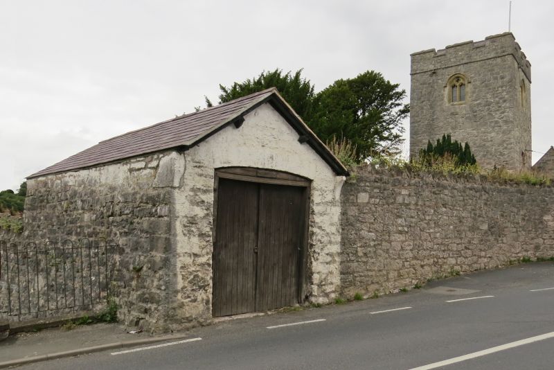
Location: Located in the SW angle of the churchyard. The NW and SE corners are joined by the churchyard boundary walls, the walls continuous to the SE.
County: Denbighshire
Town: Ruthin
Community: Ruthin (Rhuthun)
Community: Ruthin
Locality: Llanfwrog
Built-Up Area: Ruthin
Traditional County: Denbighshire
Tagged with: Hearse house
Dated 1835. Shown on the 1st edition Ordnance Survey of 1874.
Single-storey gable-fronted range, constructed of white-washed random stone under a slate roof; the verges are supported on hollow-moulded stone kneelers. South gable end has wide entrance fronting road, with double boarded doors under a segmental head of stone voussoirs. North gable end, facing into churchyard, has single boarded door under a segmental head of stone voussoirs, above which is a pointed-arched stone surround, possibly medieval and re-used from the church; this contains a slate tablet reading '1835 / Rev. Newcome MA / Warden of Ruthin / Archdeacon Merioneth.' The churchwardens are listed below.
Listed as a rare type of ancillary church building, little-altered and retaining its early C19 character. Group value with Church of St Mwrog and associated structures.
External links are from the relevant listing authority and, where applicable, Wikidata. Wikidata IDs may be related buildings as well as this specific building. If you want to add or update a link, you will need to do so by editing the Wikidata entry.


Other nearby listed buildings