Approximate Location Map
Large Map »
Latitude: 52.0817 / 52°4'54"N
Longitude: -4.6637 / 4°39'49"W
OS Eastings: 217575
OS Northings: 245943
OS Grid: SN175459
Mapcode National: GBR CZ.C3VB
Mapcode Global: VH2MP.3YV1
Plus Code: 9C4Q38JP+MG
Entry Name: Quay Walls
Listing Date: 18 April 2006
Last Amended: 18 April 2006
Grade: II
Source: Cadw
Source ID: 87485
Building Class: Maritime
ID on this website: 300087485
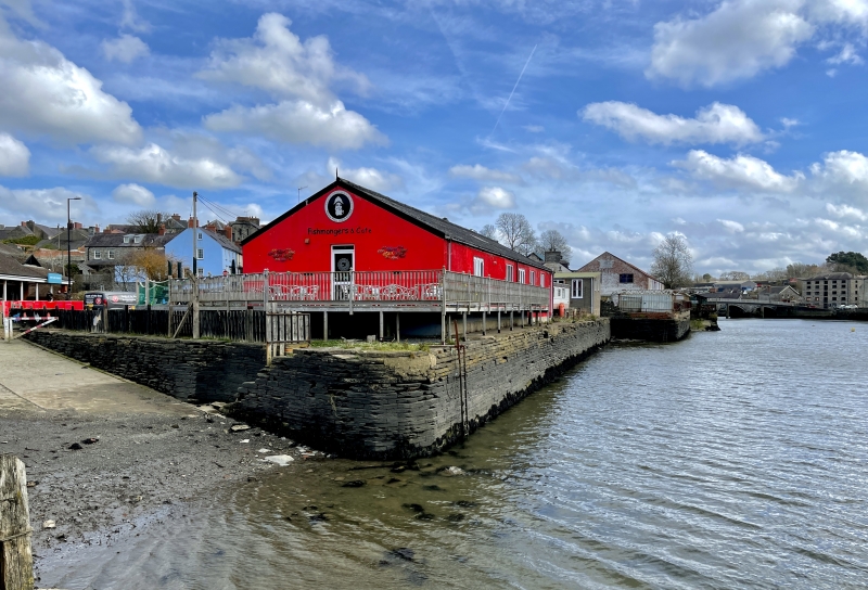
Location: The walls form the SE side of a slipway at the W end of Cambrian Quay, and thence run SE for a distance of some 60m alongside the river to the projecting section of a further quay. The slipway is acce
County: Ceredigion
Town: Cardigan
Community: Cardigan (Aberteifi)
Community: Cardigan
Locality: Cambrian Quay
Built-Up Area: Cardigan
Traditional County: Cardiganshire
Tagged with: Wall
The quay walls are probably c1810-1820, and are shown on Wood's map of the town of 1834. With surviving warehouses close to the river, they are an important reminder of the significance of maritime trade in the growth and development of Cardigan, especially during the C19. The port had been ranked ninth amongst the leading ports handling coastal trade of England and Wales (excluding London) in 1775-1780, and in 1835, 291 ships belonged to the port. Imports included timber from North America and Norway, coal and culm, manufactured goods, whilst agricultural produce dominated the export trade. The port maintained a role in maritime trade until the arrival of the railway in the later C19, and the subsequent silting up of the estuary.
Quay walls. Built of dressed narrow blocks of local stone and capped with big slabs. In plan, the walls curve round the angle of slipway and main river frontage, and there is a further curved offset alongside the slipway, where there is also a flight of steps alongside the wall.
Listed as a well preserved section of early C19 wharf walls, which are a fine example of their type, and which are of historic interest as indicating the importance of coastal trade to the economy of Cardigan.
External links are from the relevant listing authority and, where applicable, Wikidata. Wikidata IDs may be related buildings as well as this specific building. If you want to add or update a link, you will need to do so by editing the Wikidata entry.


Other nearby listed buildings
