Approximate Location Map
Large Map »
Latitude: 51.6441 / 51°38'38"N
Longitude: -1.8545 / 1°51'16"W
OS Eastings: 410165
OS Northings: 193933
OS Grid: SU101939
Mapcode National: GBR 3RV.ZXY
Mapcode Global: VHB2Z.SYZ0
Plus Code: 9C3WJ4VW+J6
Entry Name: 71, High Street
Listing Date: 25 August 1976
Grade: II
Source: Historic England
Source ID: 1023114
English Heritage Legacy ID: 317811
ID on this website: 101023114
Location: Cricklade, Wiltshire, SN6
County: Wiltshire
Civil Parish: Cricklade
Built-Up Area: Cricklade
Traditional County: Wiltshire
Lieutenancy Area (Ceremonial County): Wiltshire
Church of England Parish: Cricklade
Church of England Diocese: Bristol
Tagged with: Building
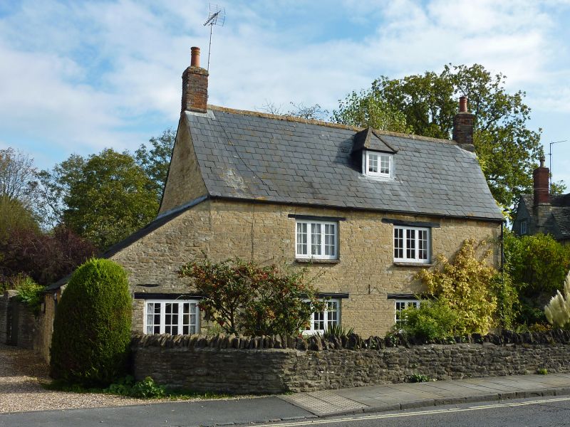
SU 19 SW CRICKLADE HIGH STREET
(east side)
13/161 No. 71
25.8.76
GV II
House. C17 or early C18. Coursed limestone rubble with Welsh
slate roof, stone slate to rear. Two storeys and attic, 2 bays,
with lean-to to left. Entrance in right gable end; half-glazed
door in rendered surround. Timber casement windows and cross
windows to first floor. Lean-to has 3-light casement. Hipped
dormer. Brick stacks to gables.
Listing NGR: SU1016593933
External links are from the relevant listing authority and, where applicable, Wikidata. Wikidata IDs may be related buildings as well as this specific building. If you want to add or update a link, you will need to do so by editing the Wikidata entry.


Other nearby listed buildings
