Latitude: 51.5508 / 51°33'2"N
Longitude: -1.7709 / 1°46'15"W
OS Eastings: 415978
OS Northings: 183570
OS Grid: SU159835
Mapcode National: GBR YSV.KS
Mapcode Global: VHB3M.8940
Plus Code: 9C3WH62H+8J
Entry Name: 2 3, the Planks
Listing Date: 17 February 1970
Grade: II
Source: Historic England
Source ID: 1023512
English Heritage Legacy ID: 318796
ID on this website: 101023512
Location: Old Town, Swindon, Wiltshire, SN3
County: Swindon
Electoral Ward/Division: Old Town
Parish: South Swindon
Built-Up Area: Swindon
Traditional County: Wiltshire
Lieutenancy Area (Ceremonial County): Wiltshire
Church of England Parish: Swindon Christ Church
Church of England Diocese: Bristol
Tagged with: Building
THE PLANKS SU 1583 NE SWINDON (west side) 8/134 Nos. 2 and 3 17.2.70 II
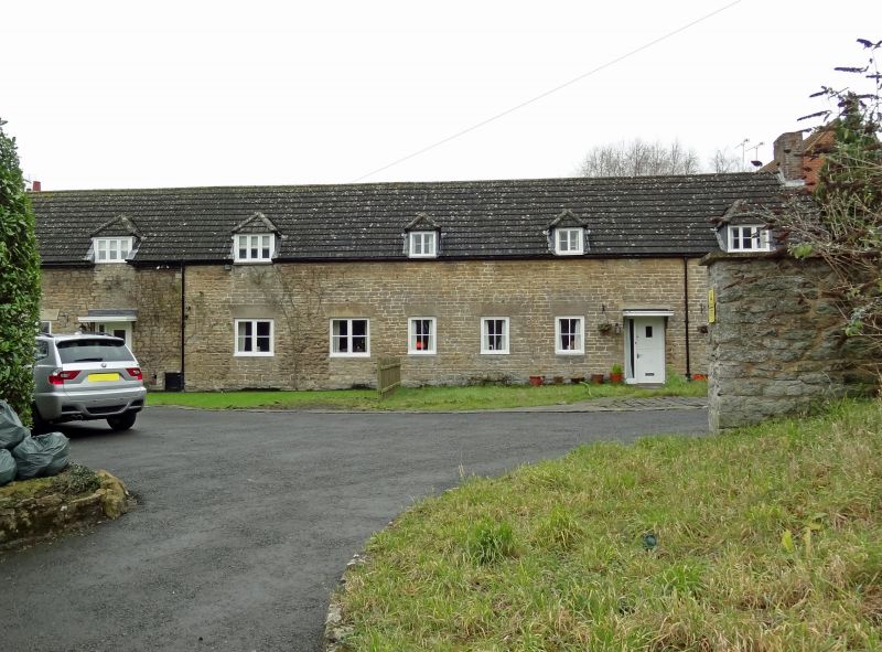
Three cottages and laundry, now 2 cottages. 1798. Built for Goddard estate. Coursed rubble, C20 interlocking tile roof. Stack at right end, others removed. Flush hipped dormers. 1 storey and attic. Timber casement windows with splayed stone lintels. Fireplaces on rear wall, datestone over fire beam in left cottage.
Listing NGR: SU1597883570
External links are from the relevant listing authority and, where applicable, Wikidata. Wikidata IDs may be related buildings as well as this specific building. If you want to add or update a link, you will need to do so by editing the Wikidata entry.


Other nearby listed buildings