Approximate Location Map
Large Map »
Latitude: 51.0717 / 51°4'18"N
Longitude: -1.797 / 1°47'49"W
OS Eastings: 414316
OS Northings: 130279
OS Grid: SU143302
Mapcode National: GBR 517.NH5
Mapcode Global: FRA 7639.5QF
Plus Code: 9C3W36C3+M5
Entry Name: Ivy Place
Listing Date: 12 October 1972
Grade: II
Source: Historic England
Source ID: 1023561
English Heritage Legacy ID: 318908
ID on this website: 101023561
Location: Salisbury, Wiltshire, SP1
County: Wiltshire
Civil Parish: Salisbury
Built-Up Area: Salisbury
Traditional County: Wiltshire
Lieutenancy Area (Ceremonial County): Wiltshire
Church of England Parish: Salisbury St Thomas and St Edmund
Church of England Diocese: Salisbury
Tagged with: Building Terrace of houses
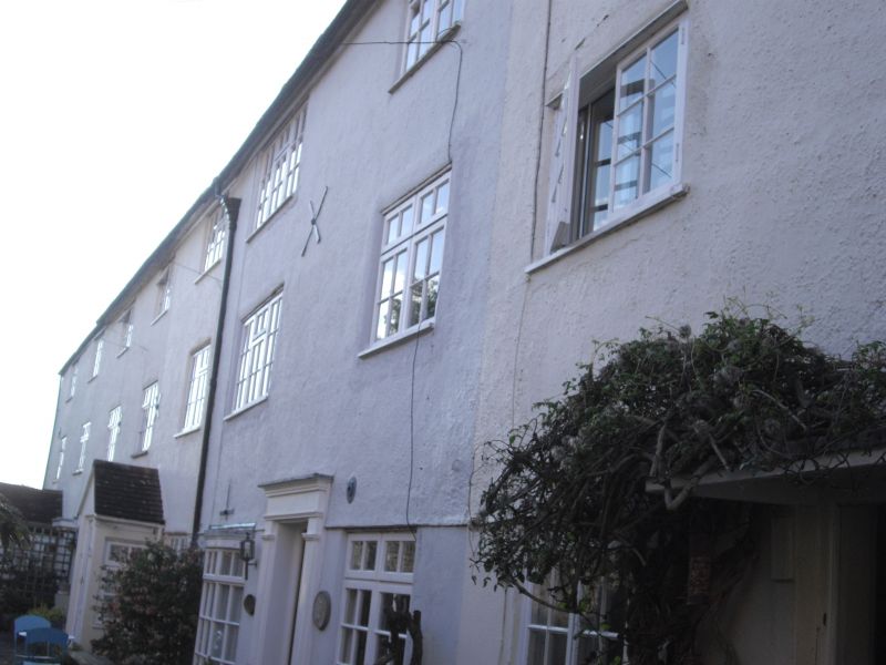
CASTLE STREET
1.
1594 (West Side)
Ivy Place
SU 1430 SW 1/406 [Nos 4 to 11 (oonsec)]
II GV
2.
Circa 18000. 3 storeys rendered brick. Common half hipped tiled roof.
Eaves band. One window each: 2 light casements with cambered heads, taller
on ground floor. Doors of 4 flush panels (some altered) in plain surrounds,
Pedimented hoods.
Nos 1 to 11 (consec) Ivy Place form a group.
Listing NGR: SU1431630279
External links are from the relevant listing authority and, where applicable, Wikidata. Wikidata IDs may be related buildings as well as this specific building. If you want to add or update a link, you will need to do so by editing the Wikidata entry.


Other nearby listed buildings
