Latitude: 51.0688 / 51°4'7"N
Longitude: -1.7944 / 1°47'39"W
OS Eastings: 414499
OS Northings: 129962
OS Grid: SU144299
Mapcode National: GBR 517.WPG
Mapcode Global: FRA 7649.6RP
Plus Code: 9C3W3694+G6
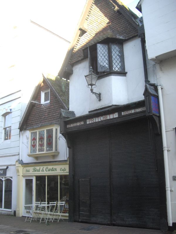
Entry Name: 3, Fish Row
Listing Date: 12 October 1972
Grade: II*
Source: Historic England
Source ID: 1023665
English Heritage Legacy ID: 319132
ID on this website: 101023665
Location: Salisbury, Wiltshire, SP1
County: Wiltshire
Civil Parish: Salisbury
Built-Up Area: Salisbury
Traditional County: Wiltshire
Lieutenancy Area (Ceremonial County): Wiltshire
Church of England Parish: Salisbury St Thomas and St Edmund
Church of England Diocese: Salisbury
Tagged with: Building
FISH ROW 1. 1594 No 3 SU 1429 NW 3/460 II* 2. C15 timber frame considerably altered exterior. 2 storeys and attic. The front has been built out from gable and rough cast with pantiled roof over 1st floor. Modern casements and modern shop front. Early small attic casement in gable however leaded lights. Roof trusses survive however with King strut to collar and purlins, curved struts to collar, curved windbraces.
Listing NGR: SU1451329958
External links are from the relevant listing authority and, where applicable, Wikidata. Wikidata IDs may be related buildings as well as this specific building. If you want to add or update a link, you will need to do so by editing the Wikidata entry.


Other nearby listed buildings