Latitude: 51.2432 / 51°14'35"N
Longitude: -0.0316 / 0°1'53"W
OS Eastings: 537493
OS Northings: 151171
OS Grid: TQ374511
Mapcode National: GBR KKC.YNL
Mapcode Global: VHGSD.D0NT
Plus Code: 9C3X6XV9+79
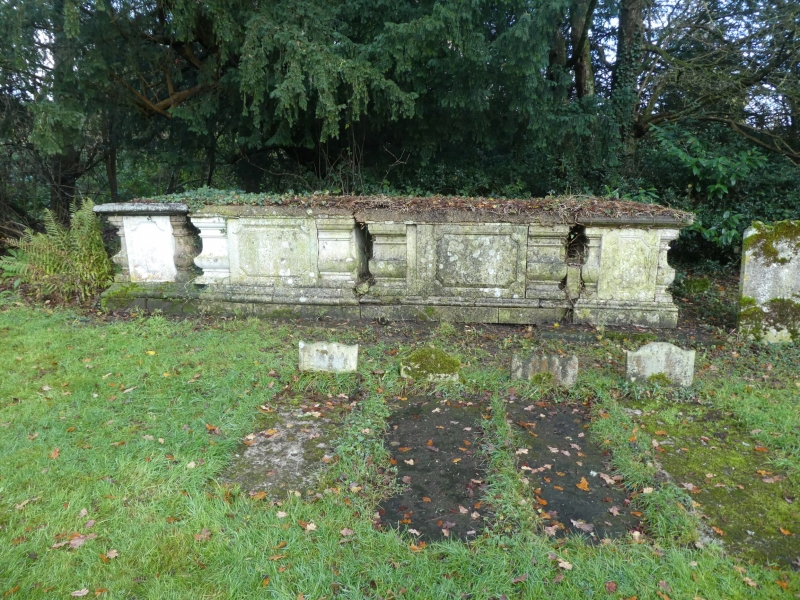
Entry Name: Chest Tombs 15 Yards East of Church of St Peter
Listing Date: 19 November 1984
Grade: II
Source: Historic England
Source ID: 1029713
English Heritage Legacy ID: 287922
ID on this website: 101029713
Location: St Peter's Church, Tandridge, Surrey, RH8
County: Surrey
District: Tandridge
Civil Parish: Tandridge
Traditional County: Surrey
Lieutenancy Area (Ceremonial County): Surrey
Church of England Parish: Tandridge St Peter
Church of England Diocese: Southwark
Tagged with: Chest tomb
TQ 35 SE
6/266
TANDRIDGE C.P.
TANDRIDGE LANE
Chest Tombs 15 yards east of Church of St.Peter
GV
II
Four chest tombs. Mid C18 to early C19 arranged with two to centre and end tombs,
projecting forward at right angles. Stone, moulded plinths with fielded panelled
sides and recessed baluster corners. End tombs with dark stone lids, centre two
joined under cement lid.
Listing NGR: TQ3749351171
External links are from the relevant listing authority and, where applicable, Wikidata. Wikidata IDs may be related buildings as well as this specific building. If you want to add or update a link, you will need to do so by editing the Wikidata entry.


Other nearby listed buildings