Latitude: 52.2763 / 52°16'34"N
Longitude: 1.3281 / 1°19'41"E
OS Eastings: 627135
OS Northings: 269457
OS Grid: TM271694
Mapcode National: GBR WN2.6M1
Mapcode Global: VHL9X.Y1YT
Plus Code: 9F4378GH+G6
Entry Name: Chantry Farmhouse
Listing Date: 18 December 1987
Grade: II
Source: Historic England
Source ID: 1032902
English Heritage Legacy ID: 280128
ID on this website: 101032902
Location: Brundish, Mid Suffolk, IP13
County: Suffolk
District: Mid Suffolk
Civil Parish: Brundish
Traditional County: Suffolk
Lieutenancy Area (Ceremonial County): Suffolk
Church of England Parish: Brundish St Lawrence
Church of England Diocese: St.Edmundsbury and Ipswich
Tagged with: Farmhouse
BRUNDISH CHURCH LANE TM 26 NE
6/8 Chantry Farmhouse -
GV II
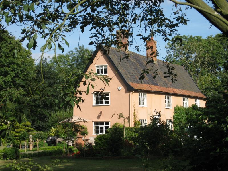
Farmhouse. Late C16 and early-mid C17, in 2 phases. Timber framed, roughcast-rendered. Pantiled roof, with glazed black tiles at the front. 2 storeys and attic. A 3-cell house extended to the right by 2 bays to form a single long range. 4 windows, mainly C18-C19 mullion and transom casements of 4 lights, with a single horizontal glazing bar to each light. To the left a doorway with C19 4-panel door (the upper panels glazed), moulded architrave with corner roundels and a bowed frieze. Right hand doorway has a C19 6-panel door, the upper 2 panels glazed. 2 internal stacks; external stack at right gable end. Interior under renovation at time of survey with much of the structure being exposed. A second stack has been inserted into the lower bay of the hall, perhaps when the house was extended. In C19 the main stack of the original range was removed to accommodate a stair and a smaller stack built to replace it, just heating the parlour. Good studding, with reversed braces to earlier work and straight corner braces at later end. Some original windows, all with ovolo mullions. Most of the joists are square, but in the service end of the original range they are set flat. Both roofs have clasped and butt purlins, that over the earlier range of better quality. Moated medieval site.
Listing NGR: TM2713569457
External links are from the relevant listing authority and, where applicable, Wikidata. Wikidata IDs may be related buildings as well as this specific building. If you want to add or update a link, you will need to do so by editing the Wikidata entry.


Other nearby listed buildings