Latitude: 52.2779 / 52°16'40"N
Longitude: 1.3194 / 1°19'9"E
OS Eastings: 626533
OS Northings: 269606
OS Grid: TM265696
Mapcode National: GBR WN1.4CW
Mapcode Global: VHL9X.T0CL
Plus Code: 9F4378H9+5P
Entry Name: Yew Tree Farm
Listing Date: 29 July 1955
Grade: II
Source: Historic England
Source ID: 1352202
English Heritage Legacy ID: 280125
ID on this website: 101352202
Location: Brundish, Mid Suffolk, IP13
County: Suffolk
District: Mid Suffolk
Civil Parish: Brundish
Traditional County: Suffolk
Lieutenancy Area (Ceremonial County): Suffolk
Church of England Parish: Brundish St Lawrence
Church of England Diocese: St.Edmundsbury and Ipswich
Tagged with: House
This list entry was subject to a Minor Amendment on 12 September 2024 to update the name and address and reformat the text to current standards.
TM 26 NE
6/5
BRUNDISH
THE THOROFARE
Yew Tree Farm
(Formerly listed as Yew Tree House, BRUNDISH)
29.7.55
II
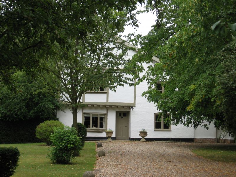
Former farmhouse; originally the cross-wing of a larger house which extended to the west. Early-mid C16 with C19 two storey addition. Timber framed; part plastered, lined to imitate ashlar to the east; ground floor mainly rebuilt in colourwashed brick. Roof has concrete plaintiles to the front and black pantiles to the rear. Two storeys. Jettied gable end to road carried on plain brackets. C18-C19 small-paned casement windows. To the east a lobby entrance with a gabled porch and mid C20 plank door. Beneath the jetty an oriel window with original cill, the remainder of the window of later date. To the right of this a C19 six-panel door. Internal stack, a C16 or early C17 insertion.
Ground floor room adjacent to jetty has closely-spaced heavy plain joists. Part of a blocked four-centre arched doorway in the gable end. The chamber above has fine heavy studding with tension braces. The open truss had solid arched braces, one of which survives; there is a similar brace in the adjacent truss now against the stack. Crown post roof: oblong crown posts, stop-chamfered but otherwise plain, with almost solid two-way braces to the collar purlin. The structure of the roof provides clear evidence for the existence of an adjoining range. Good newel stair with original treads. Remains of medieval moat.
Listing NGR: TM2653369606
External links are from the relevant listing authority and, where applicable, Wikidata. Wikidata IDs may be related buildings as well as this specific building. If you want to add or update a link, you will need to do so by editing the Wikidata entry.


Other nearby listed buildings