Latitude: 51.2846 / 51°17'4"N
Longitude: -2.0542 / 2°3'15"W
OS Eastings: 396314
OS Northings: 153942
OS Grid: ST963539
Mapcode National: GBR 2VQ.HGB
Mapcode Global: VHB4M.BZW3
Plus Code: 9C3V7WMW+R8
Entry Name: 30, High Street
Listing Date: 28 June 1984
Grade: II
Source: Historic England
Source ID: 1033865
English Heritage Legacy ID: 311235
ID on this website: 101033865
Location: Erlestoke, Wiltshire, SN10
County: Wiltshire
Civil Parish: Erlestoke
Traditional County: Wiltshire
Lieutenancy Area (Ceremonial County): Wiltshire
Church of England Parish: Erlestoke Holy Saviour
Church of England Diocese: Salisbury
Tagged with: Building
ST 96 53 ERLESTOKE HIGH STREET (north side)
15/85 No 30
28.6.84
GV II
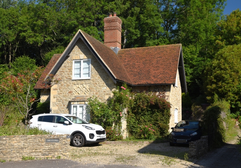
Estate cottage, early C19, rubble stone with plain tile eaves roof and centre stack. One and a half storeys, cross plan, picturesque cottage style. Ashlar flush quoins. Front gable to road has first floor casement pair with stone voussoirs and keystone and ground floor small oriel with moulded stone head and base and 1-2-1 light renewed casements. Above oriel is inset a piece of C15 carved stonework with four identical coats of arms in large quatrefoil. West gable has door with renewed cambered head and casement pair over. An estate cottage of the Erlestoke Park estate, one of several embellished with fragments of carved stonework. Probably built for G. Watson-Taylor, owner 1819-32.
Listing NGR: ST9631453942
External links are from the relevant listing authority and, where applicable, Wikidata. Wikidata IDs may be related buildings as well as this specific building. If you want to add or update a link, you will need to do so by editing the Wikidata entry.


Other nearby listed buildings