Latitude: 51.2848 / 51°17'5"N
Longitude: -2.0535 / 2°3'12"W
OS Eastings: 396364
OS Northings: 153962
OS Grid: ST963539
Mapcode National: GBR 2VQ.HMR
Mapcode Global: VHB4M.CY7Z
Plus Code: 9C3V7WMW+WH
Entry Name: Brook Cottage
Listing Date: 3 April 1987
Grade: II
Source: Historic England
Source ID: 1300589
English Heritage Legacy ID: 311232
ID on this website: 101300589
Location: Erlestoke, Wiltshire, SN10
County: Wiltshire
Civil Parish: Erlestoke
Traditional County: Wiltshire
Lieutenancy Area (Ceremonial County): Wiltshire
Church of England Parish: Erlestoke Holy Saviour
Church of England Diocese: Salisbury
Tagged with: Cottage
ST 96 53 ERLESTOKE HIGH STREET (north side)
15/82 No 20 (Brook Cottage)
GV II
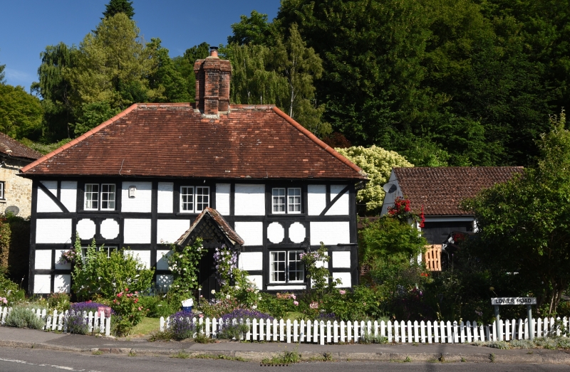
House, late C17 or early C18, timber-framed largely fronted in painted brick with early C20 applied half-timbering. Plain tile hipped roof with ridge stack. 2 storeys, 3-window range of casement pairs with centre door in gabled rustic porch. Front elevation is clad in C20 decorative timbering, west side is painted brick. East side has original timbering exposed with angle braces.
Listing NGR: ST9636453962
External links are from the relevant listing authority and, where applicable, Wikidata. Wikidata IDs may be related buildings as well as this specific building. If you want to add or update a link, you will need to do so by editing the Wikidata entry.


Other nearby listed buildings