Latitude: 52.2452 / 52°14'42"N
Longitude: 0.7126 / 0°42'45"E
OS Eastings: 585286
OS Northings: 264248
OS Grid: TL852642
Mapcode National: GBR QF0.6YP
Mapcode Global: VHKD4.9TLP
Plus Code: 9F426PW7+32
Entry Name: 9, 9A and 9B, the Traverse
Listing Date: 12 July 1972
Grade: II
Source: Historic England
Source ID: 1038273
English Heritage Legacy ID: 467588
ID on this website: 101038273
Location: Bury St Edmunds, West Suffolk, IP33
County: Suffolk
District: West Suffolk
Civil Parish: Bury St Edmunds
Built-Up Area: Bury St Edmunds
Traditional County: Suffolk
Lieutenancy Area (Ceremonial County): Suffolk
Church of England Parish: Bury St Edmunds St John the Evangelist
Church of England Diocese: St.Edmundsbury and Ipswich
Tagged with: Building
BURY ST EDMUNDS
TL8564SW THE TRAVERSE 639-1/14/637 Nos.9, 9A AND 9B 12/07/72
GV II
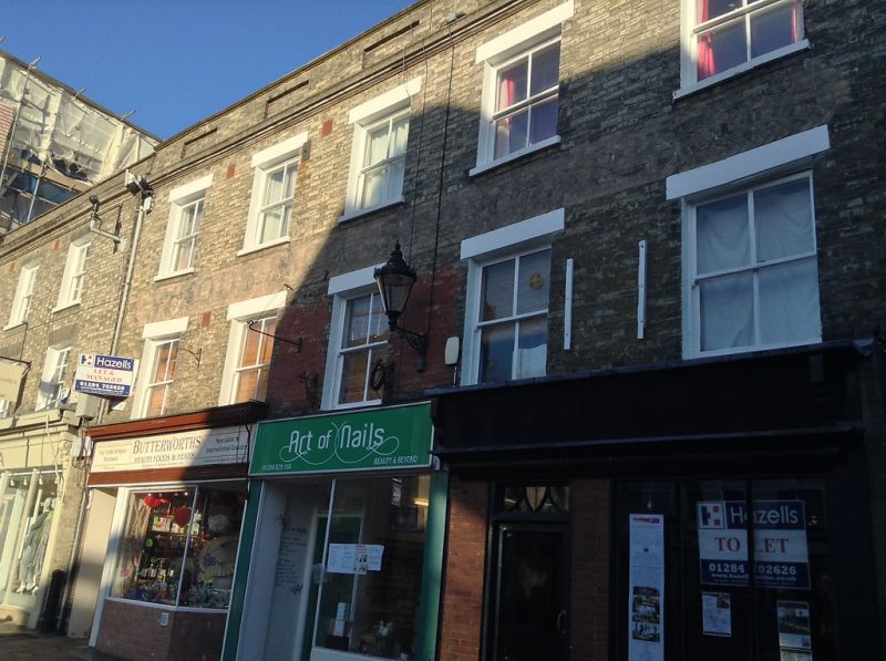
House, now divided into 3 shops on the ground floor and flats above. Early C19. Fronted in white brick with a panelled parapet and a moulded stone cornice. Slate roof. EXTERIOR: 3 storeys. 5 window range, all sashes with a single vertical glazing-bar to lights in plain reveals with stuccoed lintels and stone sills. Above the 1st storey windows segmental arches in the brickwork are infilled with diaper brick. There are the remains of old signs painted on the upper part of the walls. The 3 shops have C20 fronts, No.9B in Regency style. The 3-storey Skinner Street frontage is partly rendered, with an irregular arrangement of small-paned sash windows in flush cased frames; one sliding sash window on the top storey. The rear of No.9B, which is now linked with No.10 The Traverse (qv), is faced in C18 red brick: a blocked window to both upper storeys and a sash window to each storey, 6-pane to the top storey, 16-pane to the 1st and ground storeys, all in flush cased frames. The ground and 1st storey windows have flat gauged arches; external shutters to the ground storey window and a door with flush panels. INTERIOR: cellar below No.9B has old render over rubble walling on which large simulated stone blocks have been outlined. A stone pillar supporting a ceiling beam has a Norman nook shaft and another similar shaft is embedded in the walling. No features exposed within any of the shops, but some exposed timbering in the top storey of the Skinner Street range.
Listing NGR: TL8528664248
External links are from the relevant listing authority and, where applicable, Wikidata. Wikidata IDs may be related buildings as well as this specific building. If you want to add or update a link, you will need to do so by editing the Wikidata entry.


Other nearby listed buildings