Latitude: 53.379 / 53°22'44"N
Longitude: -1.4894 / 1°29'21"W
OS Eastings: 434064
OS Northings: 387024
OS Grid: SK340870
Mapcode National: GBR 9CL.5J
Mapcode Global: WHDDP.3B1G
Plus Code: 9C5W9GH6+H6
Entry Name: 329-335, Glossop Road
Listing Date: 9 December 1988
Grade: II
Source: Historic England
Source ID: 1038969
English Heritage Legacy ID: 458286
ID on this website: 101038969
Location: Broomfield, Sheffield, South Yorkshire, S10
County: Sheffield
Electoral Ward/Division: Broomhill and Sharrow Vale
Parish: Non Civil Parish
Built-Up Area: Sheffield
Traditional County: Yorkshire
Lieutenancy Area (Ceremonial County): South Yorkshire
Church of England Parish: Sheffield Broomhill St Mark
Church of England Diocese: Sheffield
Tagged with: Building
SHEFFIELD
SK3487SW GLOSSOP ROAD 784-1/22/367 (South East side) 09/12/88 Nos.329-335 (Odd)
GV II
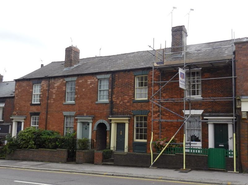
4 houses. c1845, with late C19 and late C20 alterations. Brick with stone dressings and slate roofs with 4 party wall stacks. Plinth. 2 storeys; 5 window range. Windows are segment-headed 12 pane sashes, with multi-keystone lintels, the ground floor windows with aprons. The upper left window is replaced by a C20 top hung casement. Central round-headed entry doorway flanked by single wooden doorcases with oval engaged columns and cornices. Beyond, 2 windows, the left one a C20 top hung casement, the right one a plain sash. Beyond again, similar single doorcases. The inner 2 doors have 6 beaded panels, the top 2 glazed. The outer doors are C19 and C20 replacements. INTERIOR not inspected.
Listing NGR: SK3406487024
External links are from the relevant listing authority and, where applicable, Wikidata. Wikidata IDs may be related buildings as well as this specific building. If you want to add or update a link, you will need to do so by editing the Wikidata entry.


Other nearby listed buildings