Approximate Location Map
Large Map »
Latitude: 53.4004 / 53°24'1"N
Longitude: -1.9823 / 1°58'56"W
OS Eastings: 401274
OS Northings: 389287
OS Grid: SK012892
Mapcode National: GBR GYL3.MR
Mapcode Global: WHB9Z.JS8K
Plus Code: 9C5WC229+53
Entry Name: Former Barn to Anderton House
Listing Date: 19 September 1977
Grade: II
Source: Historic England
Source ID: 1039937
English Heritage Legacy ID: 81823
ID on this website: 101039937
Location: Rowarth, High Peak, Derbyshire, SK22
County: Derbyshire
District: High Peak
Civil Parish: New Mills
Traditional County: Derbyshire
Lieutenancy Area (Ceremonial County): Derbyshire
Church of England Parish: New Mills St George
Church of England Diocese: Derby
Tagged with: Barn
NEW MILLS CHAPEL STREET
1.
5172
(North Side)
Former Barn to
SK 08 NW 4/65A Anderton House
II
GV
2.
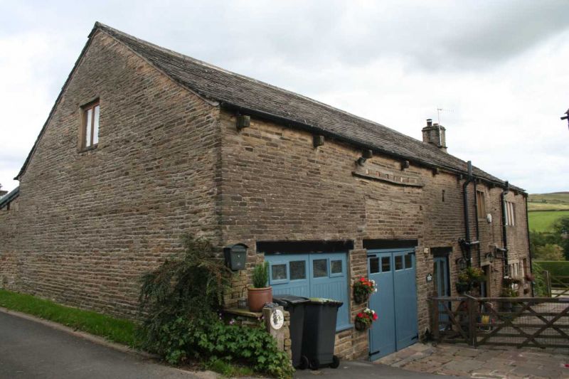
Late C18 barn of 2 storey height in coursed stone. Cart entry. 2 doors and 2
windows to ground floor. 1 window to 1st floor. Included solely for group value
with Anderton House.
Listing NGR: SK0127489287
External links are from the relevant listing authority and, where applicable, Wikidata. Wikidata IDs may be related buildings as well as this specific building. If you want to add or update a link, you will need to do so by editing the Wikidata entry.


Other nearby listed buildings
