Latitude: 53.3931 / 53°23'35"N
Longitude: -1.9854 / 1°59'7"W
OS Eastings: 401069
OS Northings: 388475
OS Grid: SK010884
Mapcode National: GBR GYK6.ZD
Mapcode Global: WHB9Z.GZT4
Plus Code: 9C5W92V7+6R
Entry Name: Thornsett Fields Farmhouse
Listing Date: 19 September 1977
Grade: II
Source: Historic England
Source ID: 1088126
English Heritage Legacy ID: 81860
ID on this website: 101088126
Location: Rowarth, High Peak, Derbyshire, SK22
County: Derbyshire
District: High Peak
Civil Parish: New Mills
Traditional County: Derbyshire
Lieutenancy Area (Ceremonial County): Derbyshire
Church of England Parish: New Mills St George
Church of England Diocese: Derby
Tagged with: Farmhouse
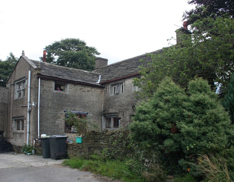
NEW MILLS THORNSET BROWS
1.
5172
(North Side)
SK 08 NW 4/100 Thornset Fields Farmhouse
II GV
2.
Cl7 farmhouse of 2 storeys, rough rendered on stone with stone slate roof with
kneelers and finials to gables. 4-light windows with mullions and transoms in
chamfered reveals beneath rectangular dripmoulds. Modern porch over door.
Listing NGR: SK0106988475
External links are from the relevant listing authority and, where applicable, Wikidata. Wikidata IDs may be related buildings as well as this specific building. If you want to add or update a link, you will need to do so by editing the Wikidata entry.


Other nearby listed buildings