Approximate Location Map
Large Map »
Latitude: 55.4265 / 55°25'35"N
Longitude: -1.7009 / 1°42'3"W
OS Eastings: 419029
OS Northings: 614769
OS Grid: NU190147
Mapcode National: GBR J5KP.KL
Mapcode Global: WHC1C.VV7W
Plus Code: 9C7WC7GX+HM
Entry Name: Milepost 80 Metres South of Broom House Roundabout
Listing Date: 25 August 1987
Grade: II
Source: Historic England
Source ID: 1042041
English Heritage Legacy ID: 236367
ID on this website: 101042041
Location: Northumberland, NE66
County: Northumberland
Civil Parish: Denwick
Traditional County: Northumberland
Lieutenancy Area (Ceremonial County): Northumberland
Church of England Parish: Alnwick
Church of England Diocese: Newcastle
Tagged with: Milestone
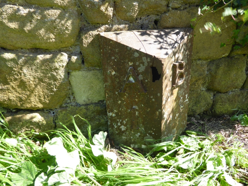
DENWICK A 1068
NU 11 SE NU 19021478
(East side)
10/30 Milepost 80 metres
south of Broom
House roundabout
II
Milepost, probably mid C19. Cast iron, painted white with black figures.
Triangular plan with open back. Legend A (Alnwick) 1, B (Belford) 13, raised
except for second figure.
Listing NGR: NU1902914769
External links are from the relevant listing authority and, where applicable, Wikidata. Wikidata IDs may be related buildings as well as this specific building. If you want to add or update a link, you will need to do so by editing the Wikidata entry.


Other nearby listed buildings
