Approximate Location Map
Large Map »
Latitude: 55.1708 / 55°10'14"N
Longitude: -1.6943 / 1°41'39"W
OS Eastings: 419571
OS Northings: 586316
OS Grid: NZ195863
Mapcode National: GBR J8LN.Z7
Mapcode Global: WHC2Q.Y9CC
Plus Code: 9C7W58C4+87
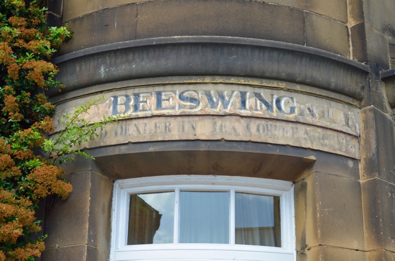
Entry Name: The Beeswing
Listing Date: 11 August 1950
Grade: II
Source: Historic England
Source ID: 1042738
English Heritage Legacy ID: 238757
ID on this website: 101042738
Location: Morpeth, Northumberland, NE61
County: Northumberland
Civil Parish: Morpeth
Built-Up Area: Morpeth
Traditional County: Northumberland
Lieutenancy Area (Ceremonial County): Northumberland
Church of England Parish: Morpeth
Church of England Diocese: Newcastle
Tagged with: Building
MORPETH NEWGATE STREET
NZ 1986 (West side)
22/268 The Beeswing
11.8.50
GV II
Formerly an inn, now a shop. Early C19. Fine ashlar with Welsh slate roof.
2 storeys, 2 bays plus rounded corner bay.
In corner bay a rounded boarded door with small glazed panels, cornice over and
rounded 12-pane sash on 1st floor. To right a canted and corniced bay window
with 15- and 10-pane fixed lights. C20 glass door to right and two 12-pane
sashes, above.
Hipped roof with banded ridge stack.
On left return five 12-pane sashes.
Listing NGR: NZ1957186316
External links are from the relevant listing authority and, where applicable, Wikidata. Wikidata IDs may be related buildings as well as this specific building. If you want to add or update a link, you will need to do so by editing the Wikidata entry.


Other nearby listed buildings
