Latitude: 54.9461 / 54°56'45"N
Longitude: -1.97 / 1°58'11"W
OS Eastings: 402020
OS Northings: 561269
OS Grid: NZ020612
Mapcode National: GBR GCP7.9R
Mapcode Global: WHB2F.QY34
Plus Code: 9C6WW2WJ+C2
Entry Name: Boundary Stone on North Side of Footpath 70 Metres East of Whiteside Cottage
Listing Date: 18 June 1986
Grade: II
Source: Historic England
Source ID: 1045395
English Heritage Legacy ID: 240431
ID on this website: 101045395
Location: Riding Mill, Northumberland, NE44
County: Northumberland
Civil Parish: Broomhaugh and Riding
Built-Up Area: Riding Mill
Traditional County: Northumberland
Lieutenancy Area (Ceremonial County): Northumberland
Church of England Parish: St James, Riding Mill
Church of England Diocese: Newcastle
Tagged with: Boundary marker
BROOMHAUGH AND RIDING BROOMHAUGH
NZ 0161 NZ 02006127
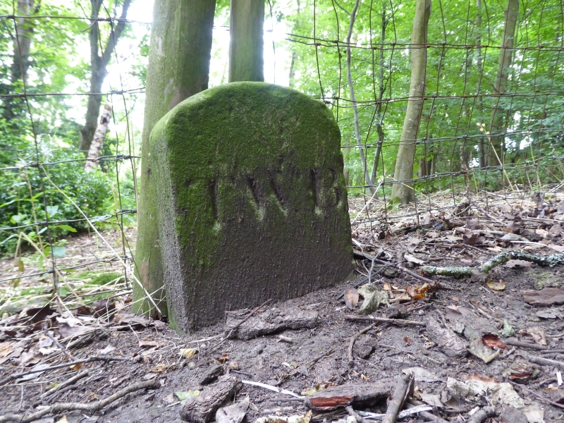
22/64 Boundary stone on
north side of footpath
70 metres east of
Whiteside Cottage
II
Boundary stone, second quarter of C19. Sandstone. Well-cut stone 0.35 metre
high with elliptical-arched top. TWB (Thomas William Beaumont) on south,
CBG (Charles Bacon Grey) on north.
Listing NGR: NZ0202061269
External links are from the relevant listing authority and, where applicable, Wikidata. Wikidata IDs may be related buildings as well as this specific building. If you want to add or update a link, you will need to do so by editing the Wikidata entry.


Other nearby listed buildings