Approximate Location Map
Large Map »
Latitude: 53.1956 / 53°11'44"N
Longitude: -0.9207 / 0°55'14"W
OS Eastings: 472202
OS Northings: 367049
OS Grid: SK722670
Mapcode National: GBR BHM.N1J
Mapcode Global: WHFGV.TYR1
Plus Code: 9C5X53WH+7P
Entry Name: Cross 12 Metres South of Church of St Michael
Listing Date: 28 April 1986
Grade: II
Source: Historic England
Source ID: 1045595
English Heritage Legacy ID: 241904
ID on this website: 101045595
Location: St Michael's Church, Laxton, Newark and Sherwood, Nottinghamshire, NG22
County: Nottinghamshire
District: Newark and Sherwood
Town: Newark and Sherwood
Civil Parish: Laxton and Moorhouse
Built-Up Area: Laxton
Traditional County: Nottinghamshire
Lieutenancy Area (Ceremonial County): Nottinghamshire
Church of England Parish: Laxton
Church of England Diocese: Southwell and Nottingham
Tagged with: Building
This list entry was subject to a Minor Amendment on 19/11/2014
SK 76 NW
4/54
LAXTON
HIGH STREET (south side)
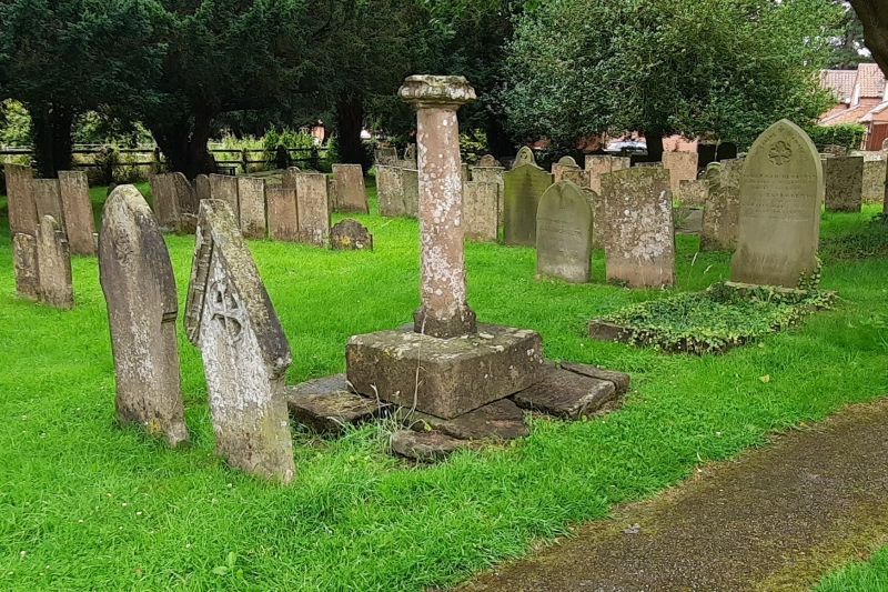
Cross 12 metres south of Church of St. Michael
(Formerly listed under MAIN STREET)
GV
II
Churchyard cross. C17. Ashlar. Square plinth carrying round
column with square base and damaged moulded square cap.
Listing NGR: SK7220267049
External links are from the relevant listing authority and, where applicable, Wikidata. Wikidata IDs may be related buildings as well as this specific building. If you want to add or update a link, you will need to do so by editing the Wikidata entry.


Other nearby listed buildings
